Article in BuShips Electron Magazine April 1949
Many thanks to Craig Hagstrom for creating the map and for images from the Bainbridge Island Historical Museum


Article in BuShips Electron Magazine April 1949 |
|||
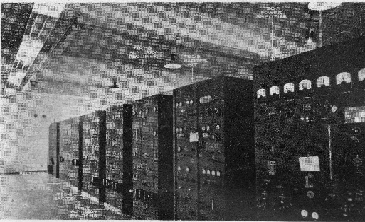
| TBC & TCG transmitters |
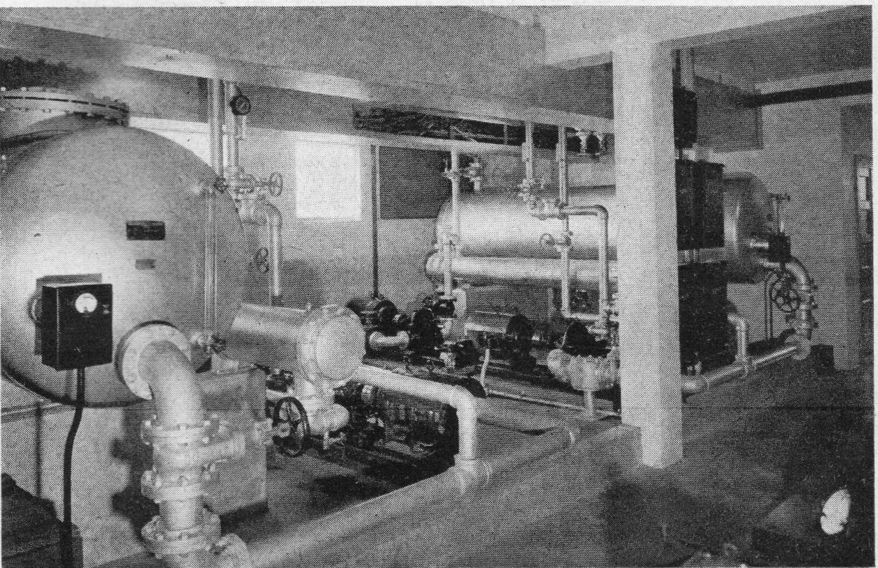
Cooling water systems for TBC and TCG |
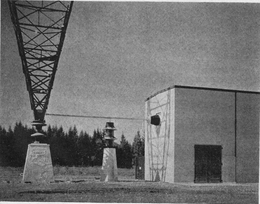
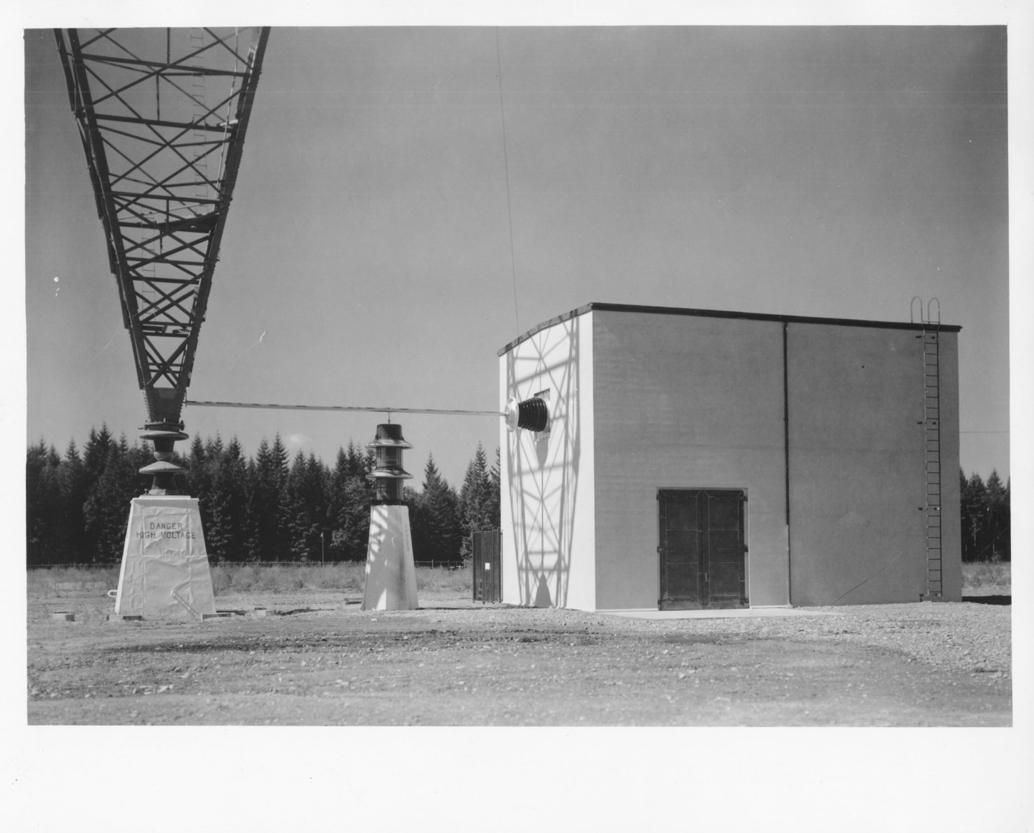
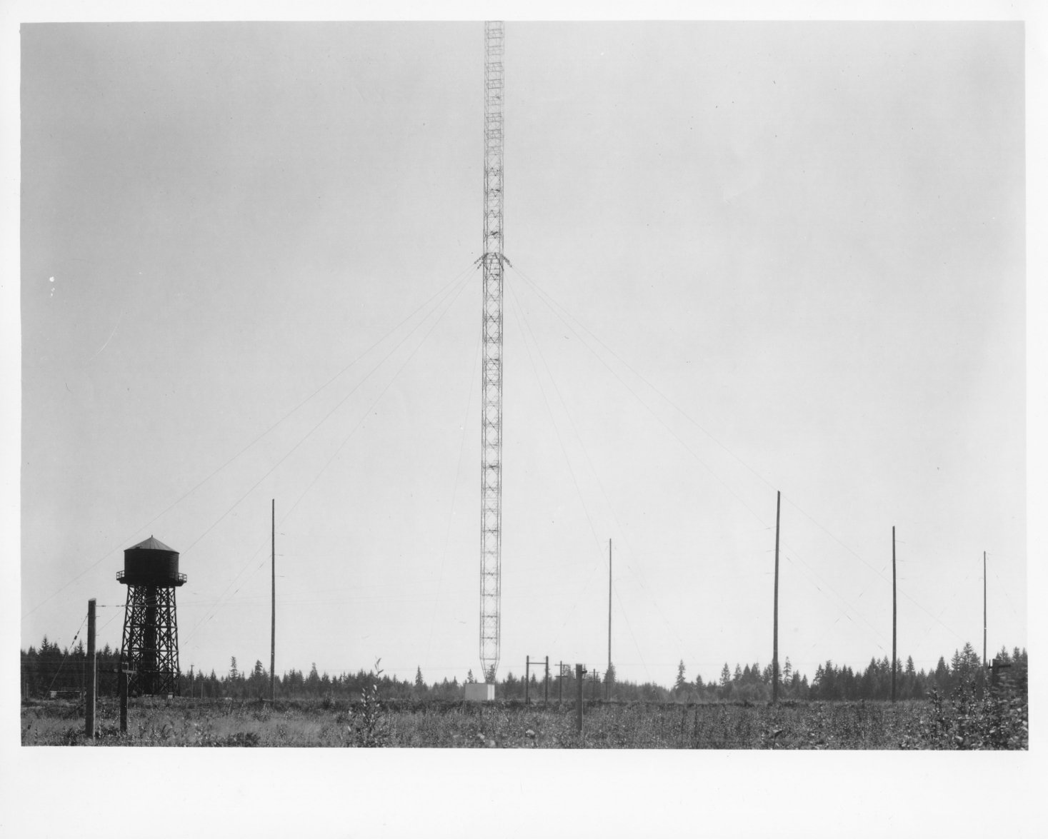
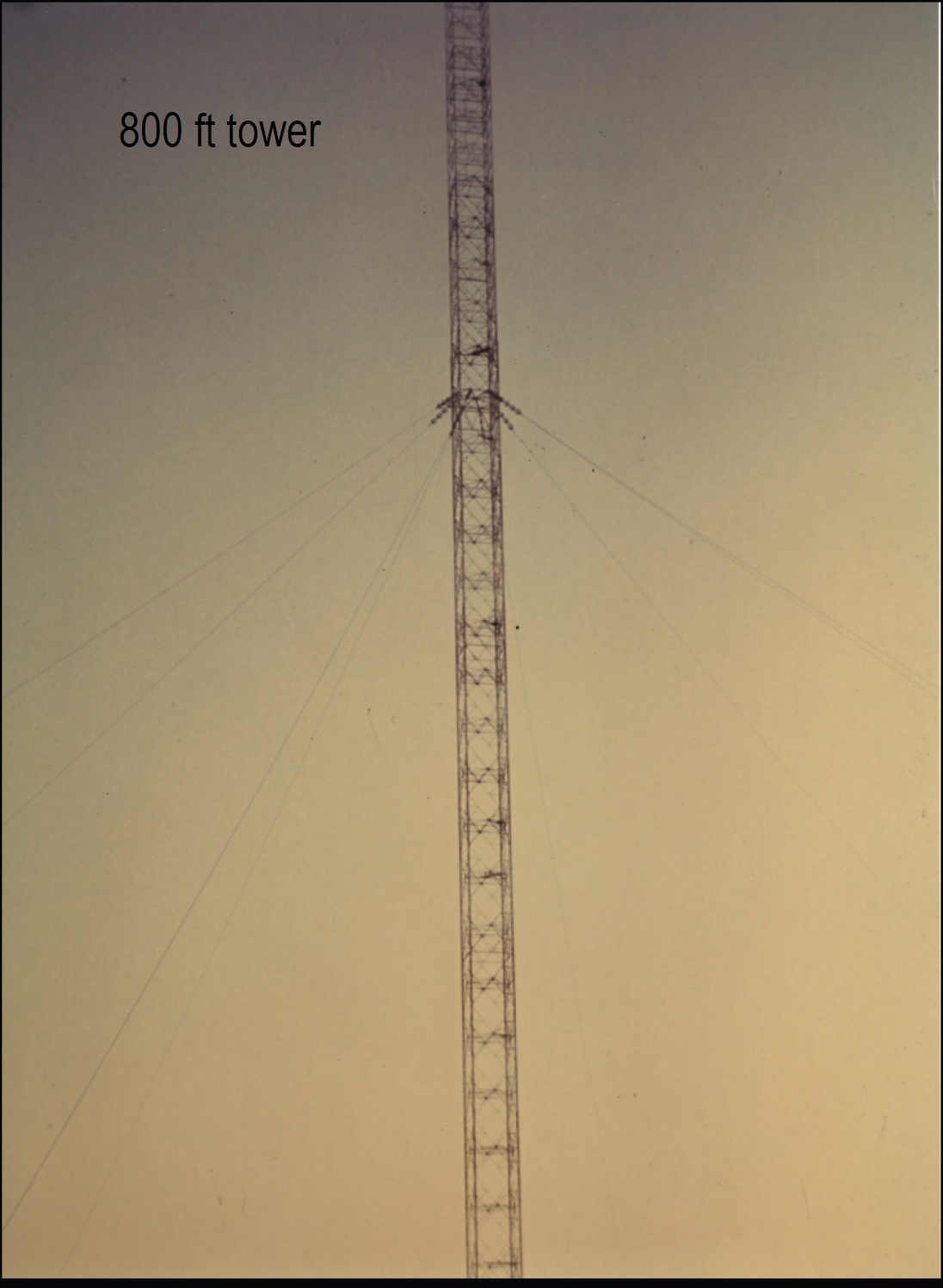
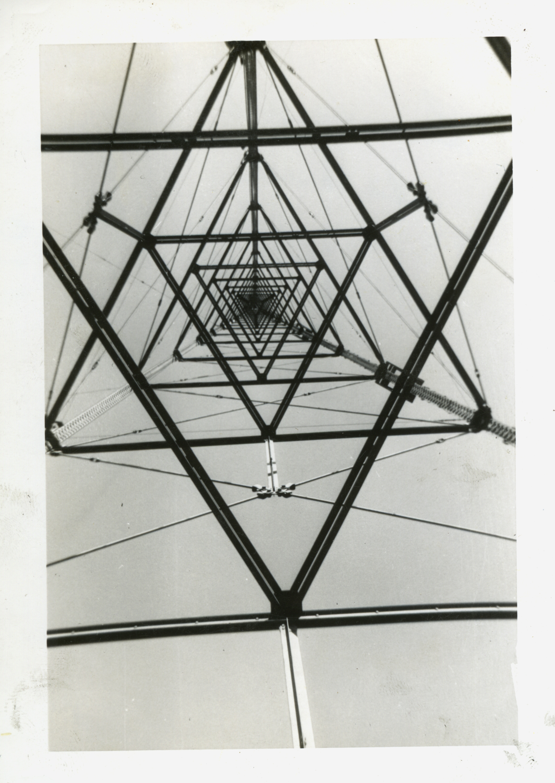
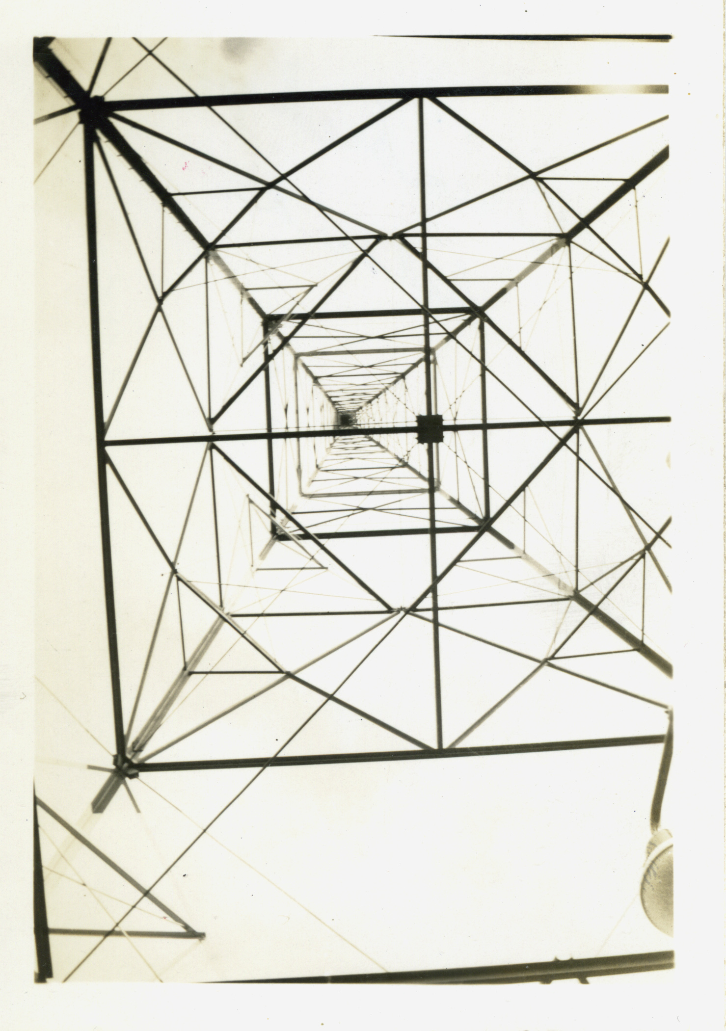
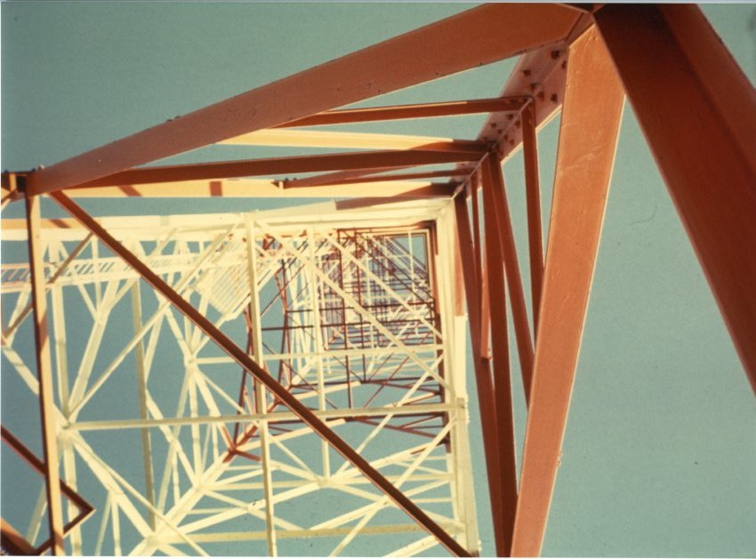
800' tower and helix house for TCG |
|
Many thanks to Craig Hagstrom for creating the map and for images from the Bainbridge Island Historical Museum |
|||
|
|
|
|
|
|
|
|
|
|
|
|
|
|
|
|
|
|
|
|
|
|
|
|
|
|
|
|
|
|
|
|
|
|
|
|
|
|
|
|
|
|
|
|
|
|
|
|
|
|
|
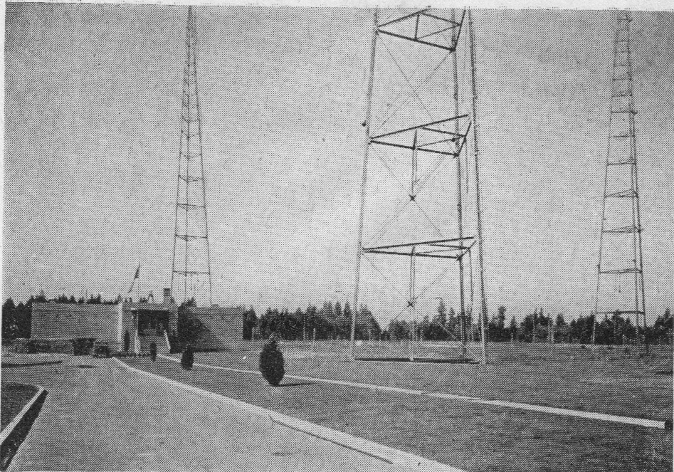
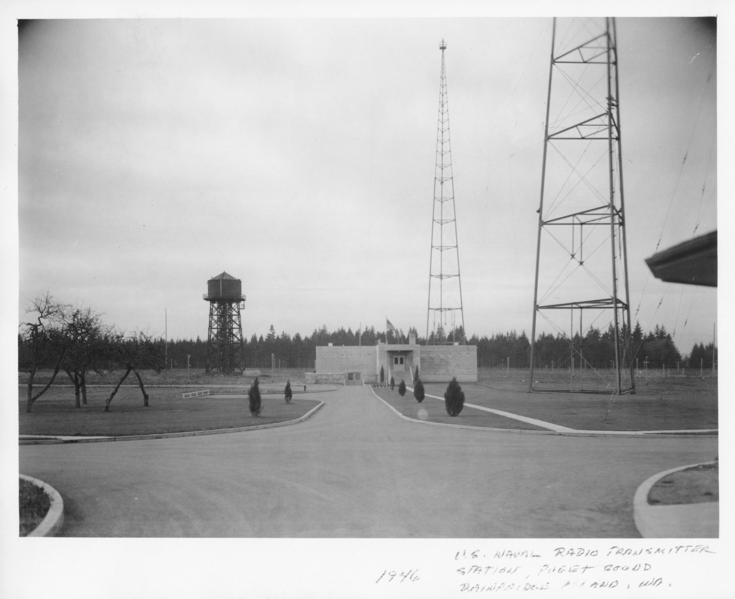
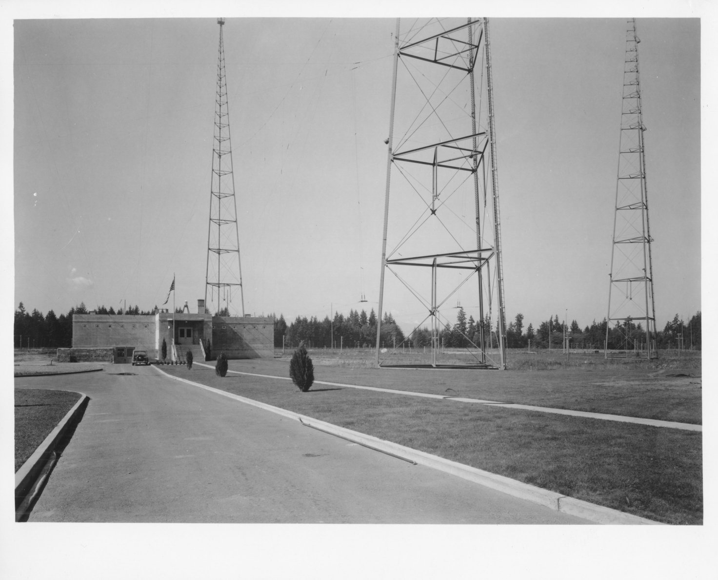
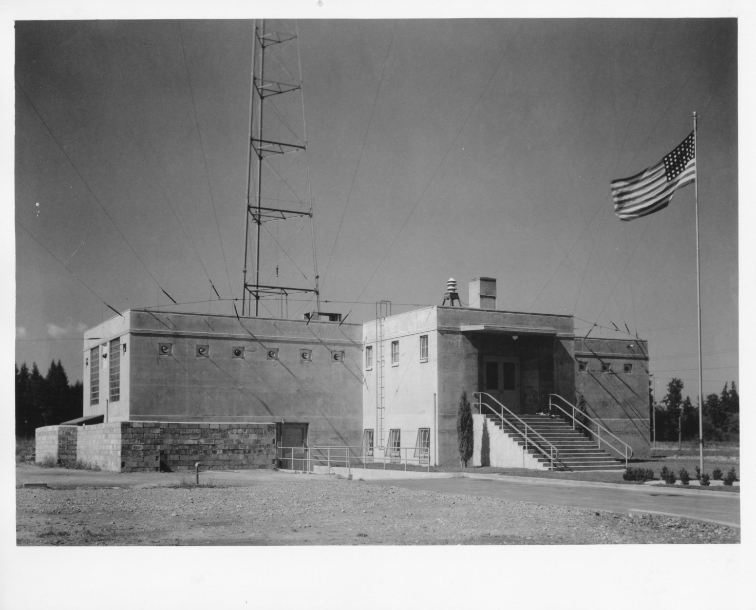
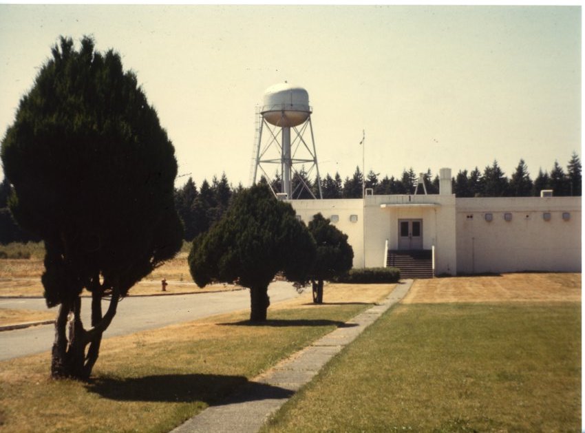
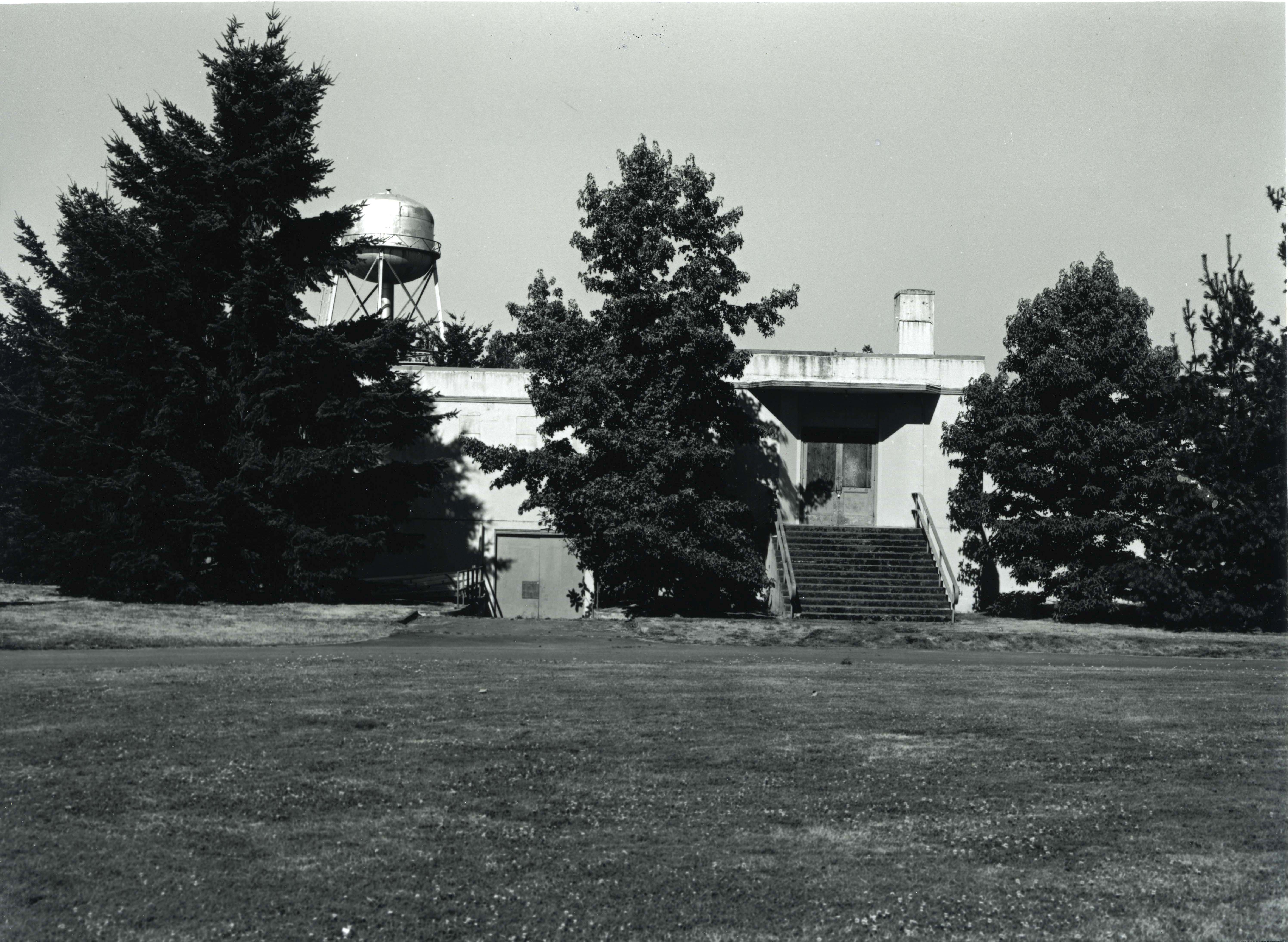
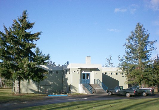
Transmitter building after renovation |
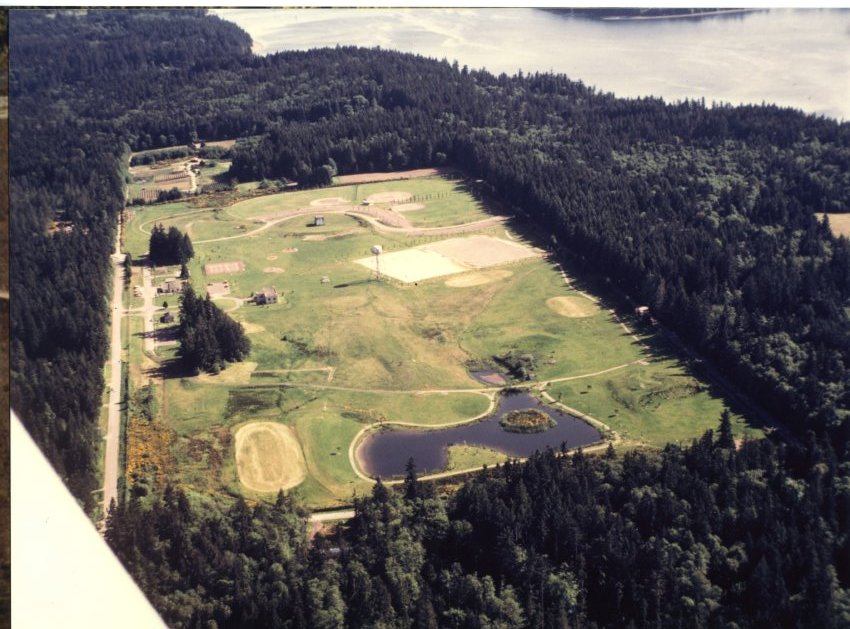
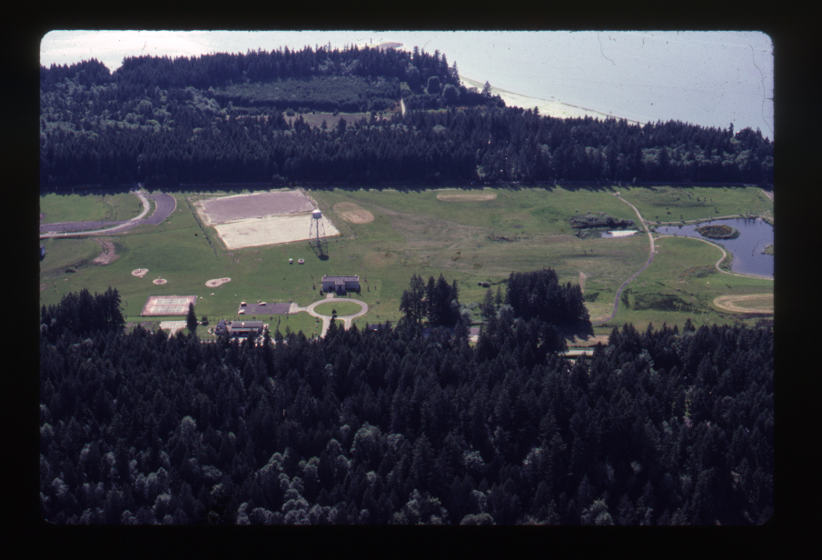
The Park District grew as park sites were donated to the new district. Rotary field on Weaver Road was added followed by former Nike sites on Strawberry Hill and south of Eagle Harbor off Rose Avenue.
The young Park District built an outdoor swimming pool on School property when a levy asking for additional funds to build an enclosed pool failed. During the summer, the Park District office was in the pool building and moved to Strawberry Hill in winter.
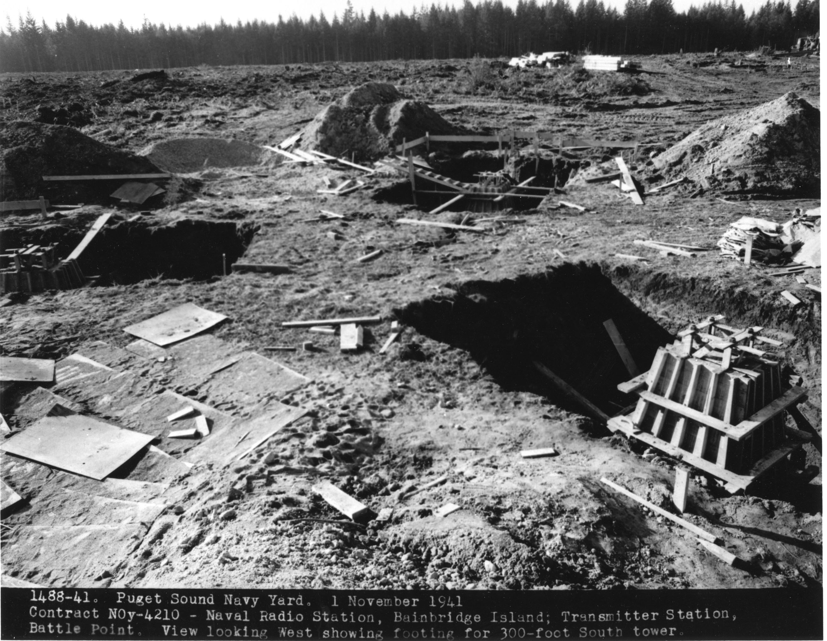
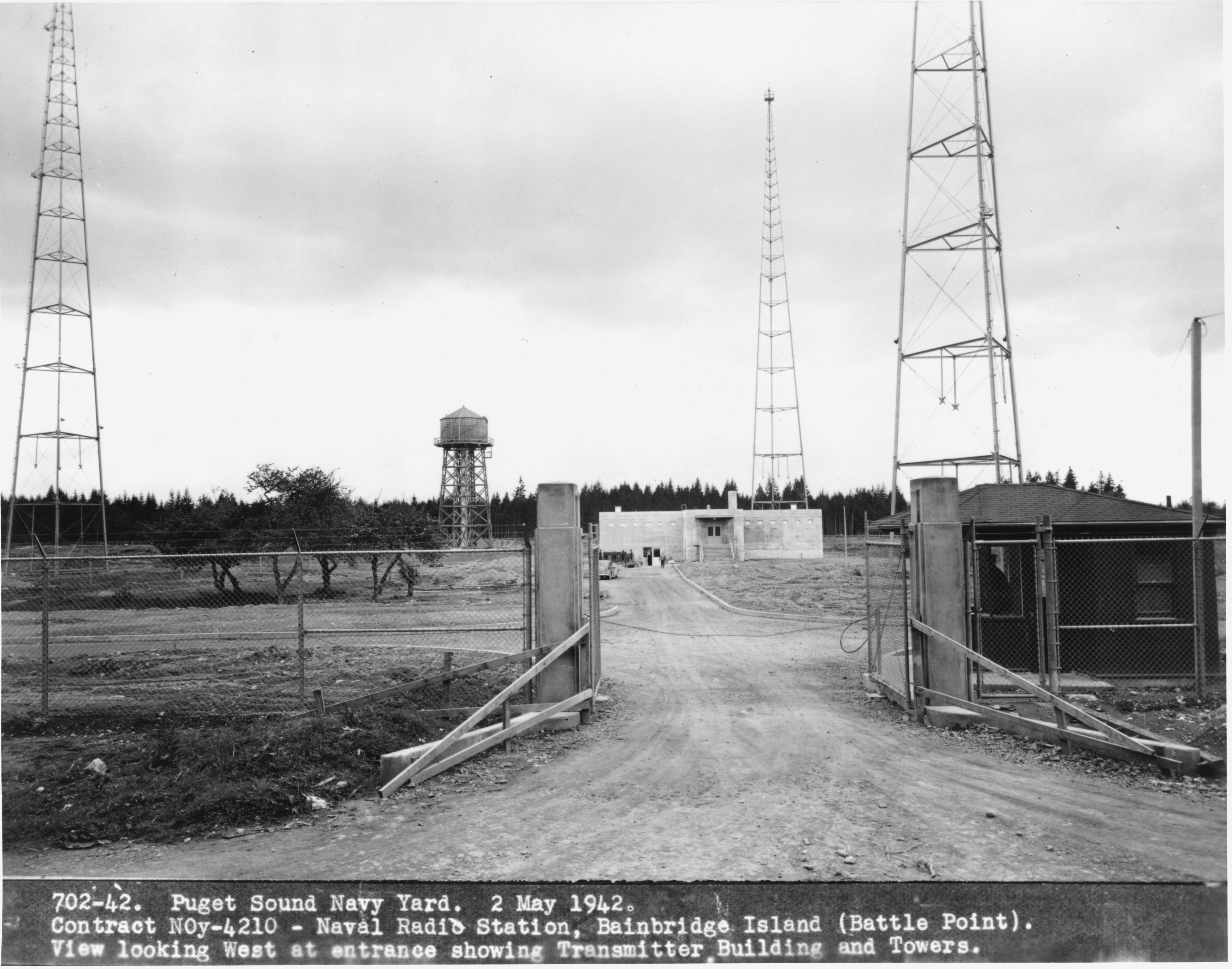
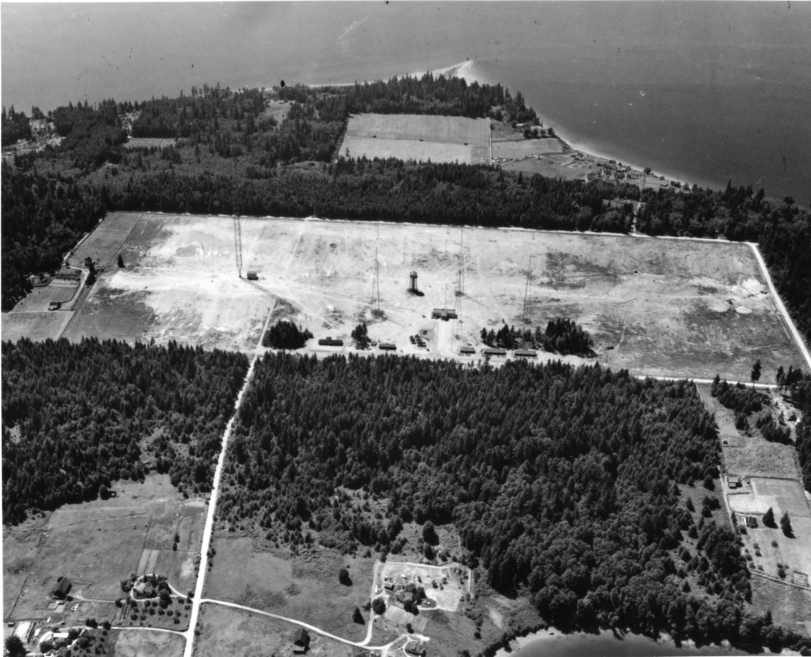
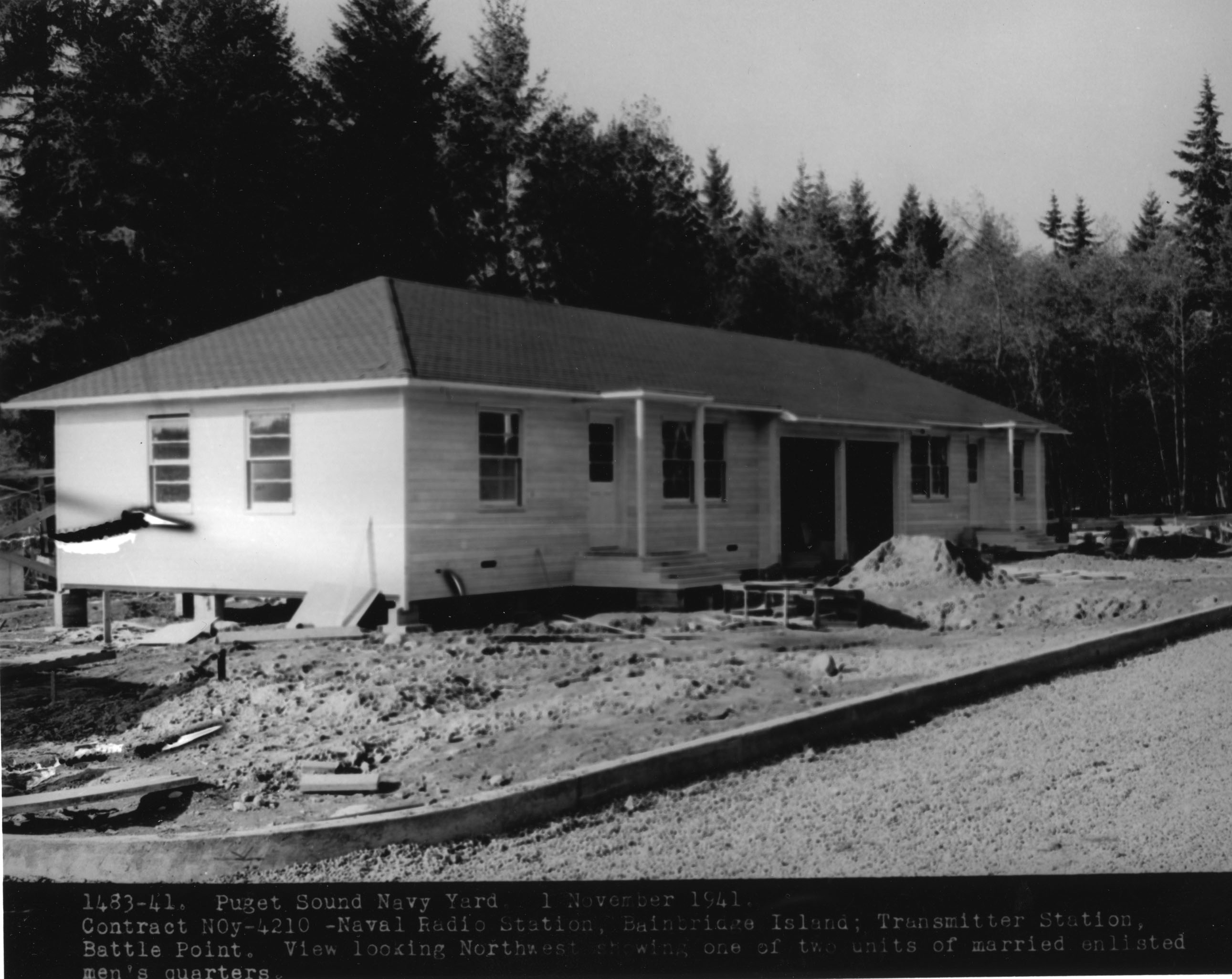
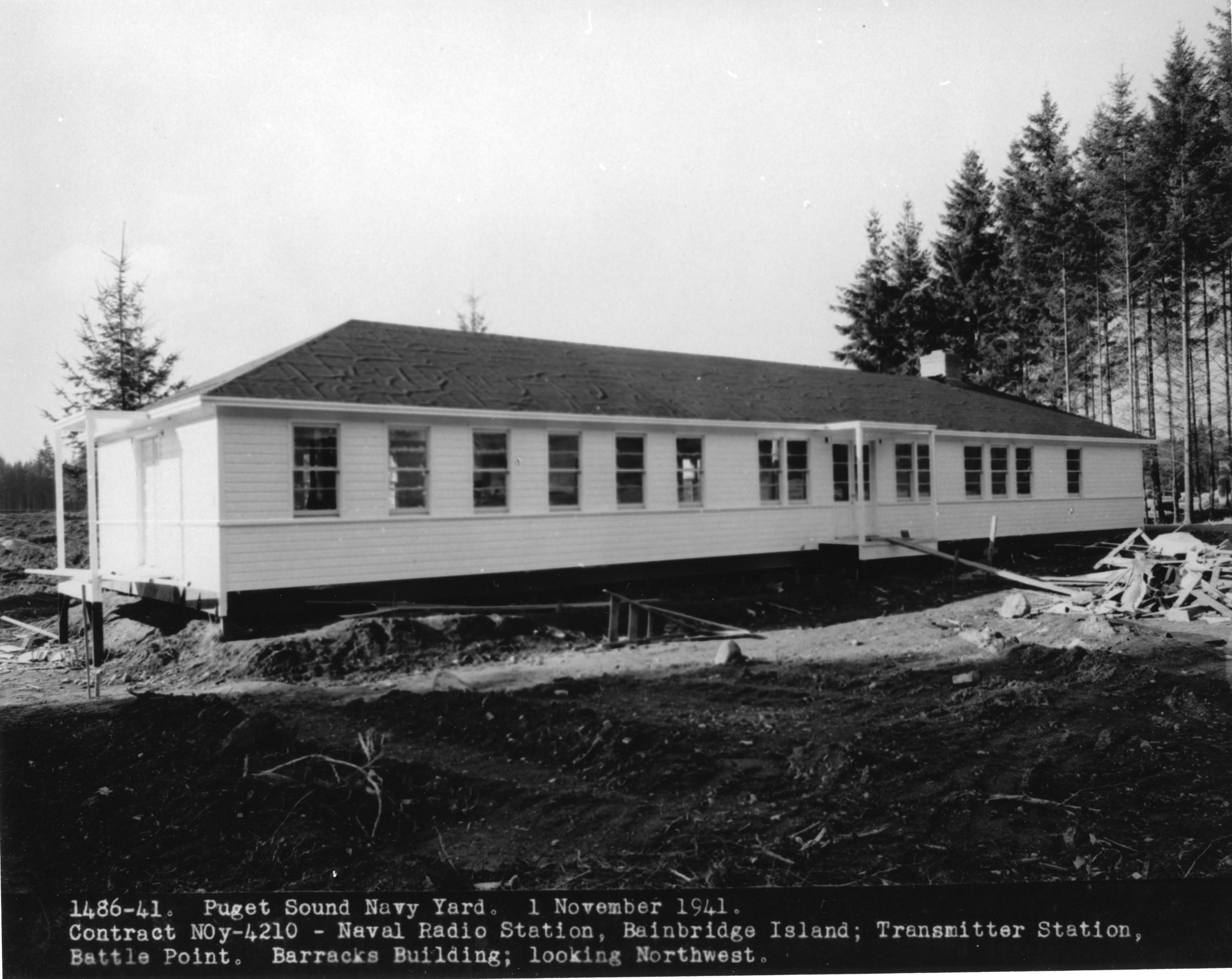
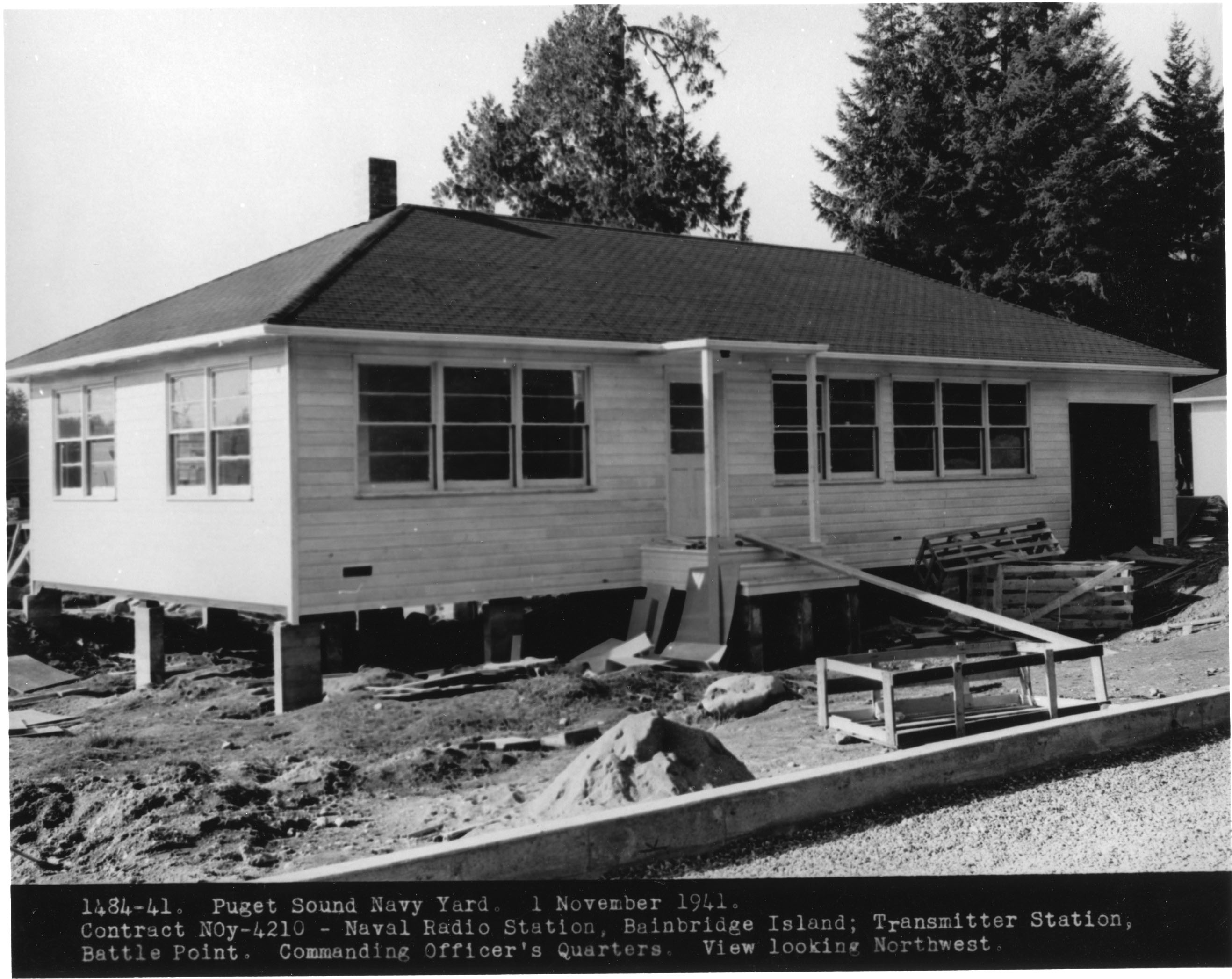
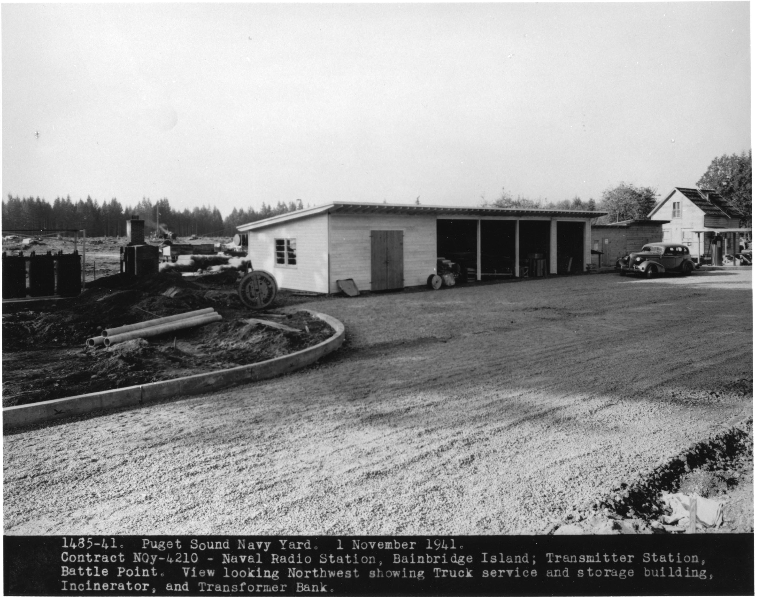
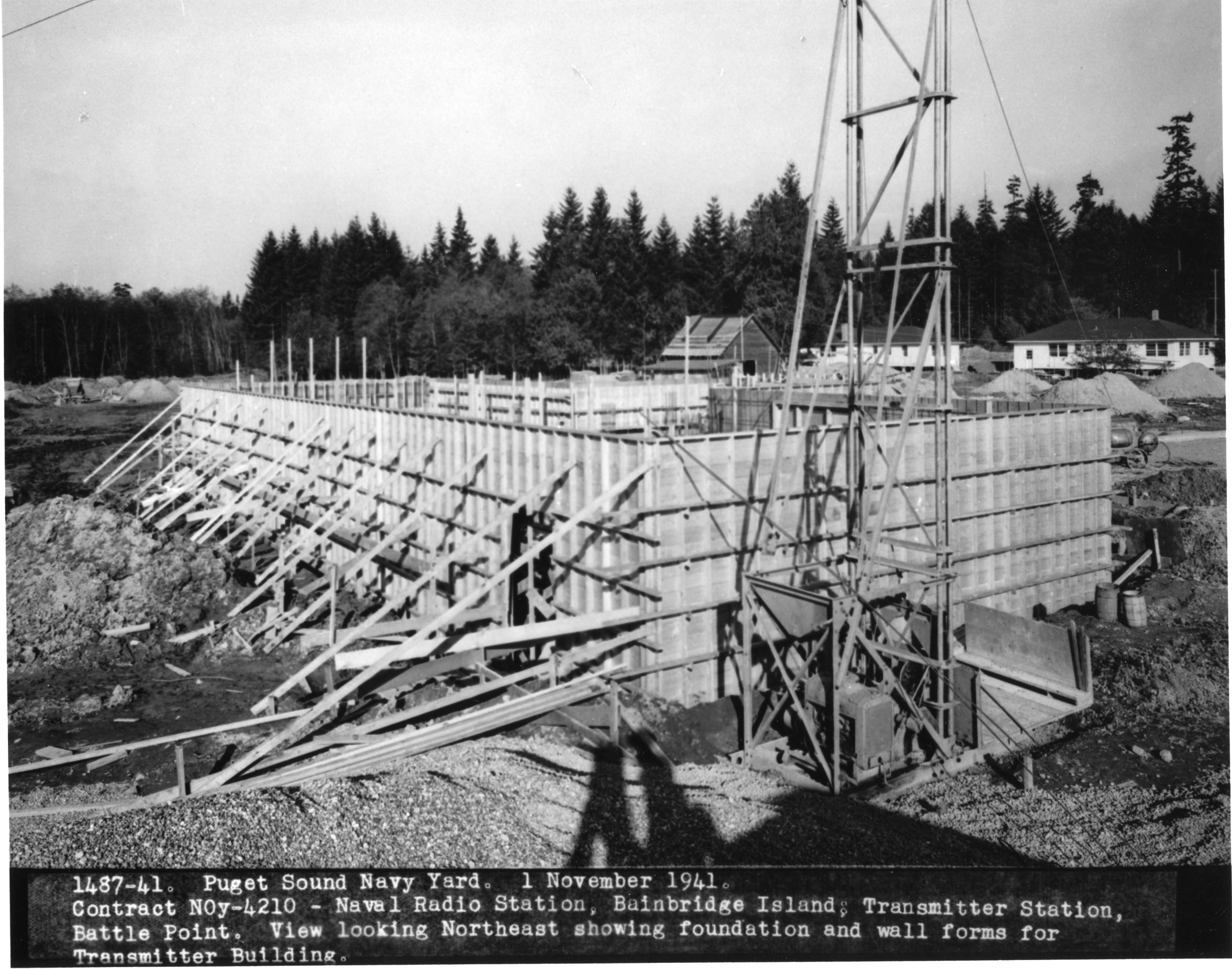
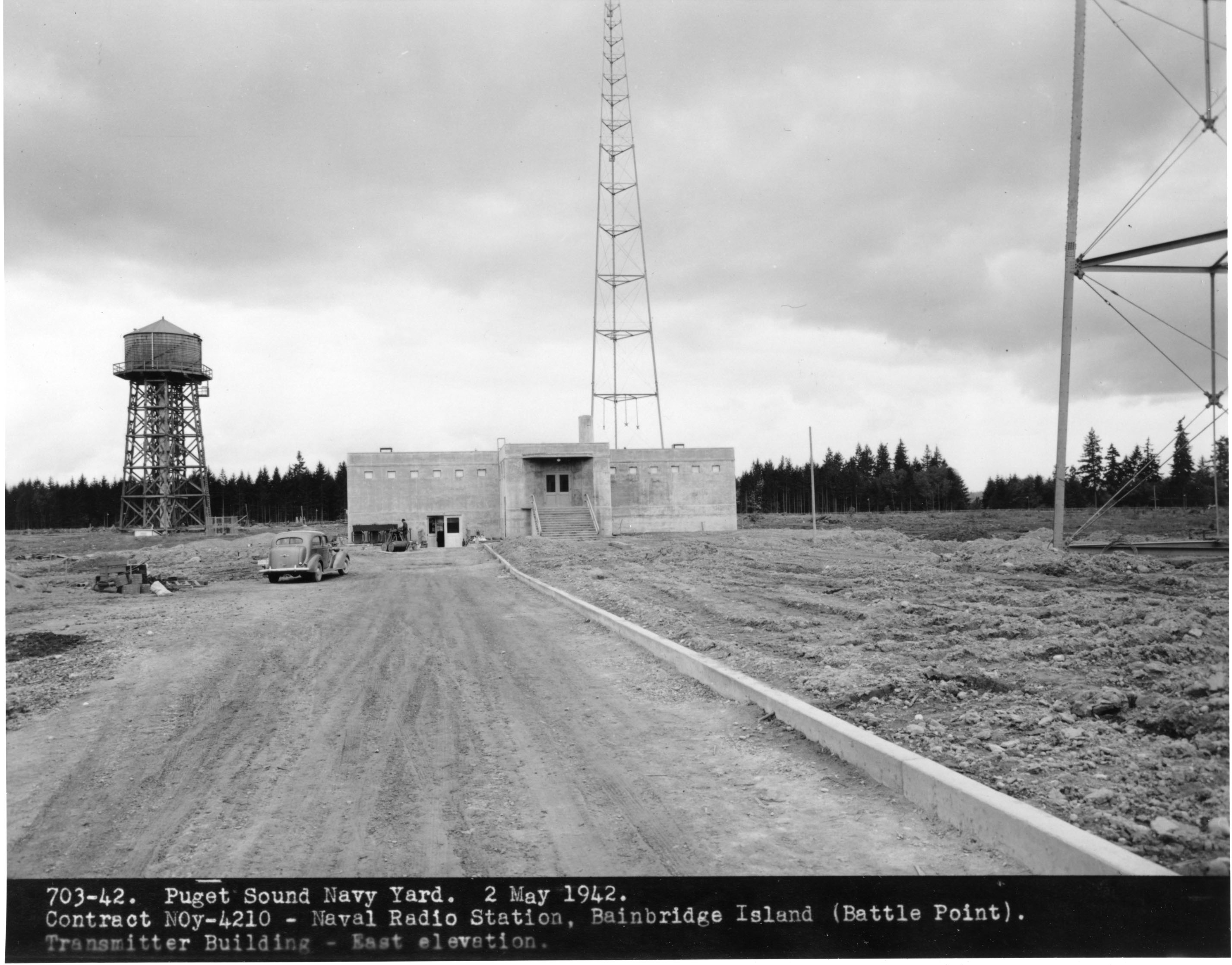
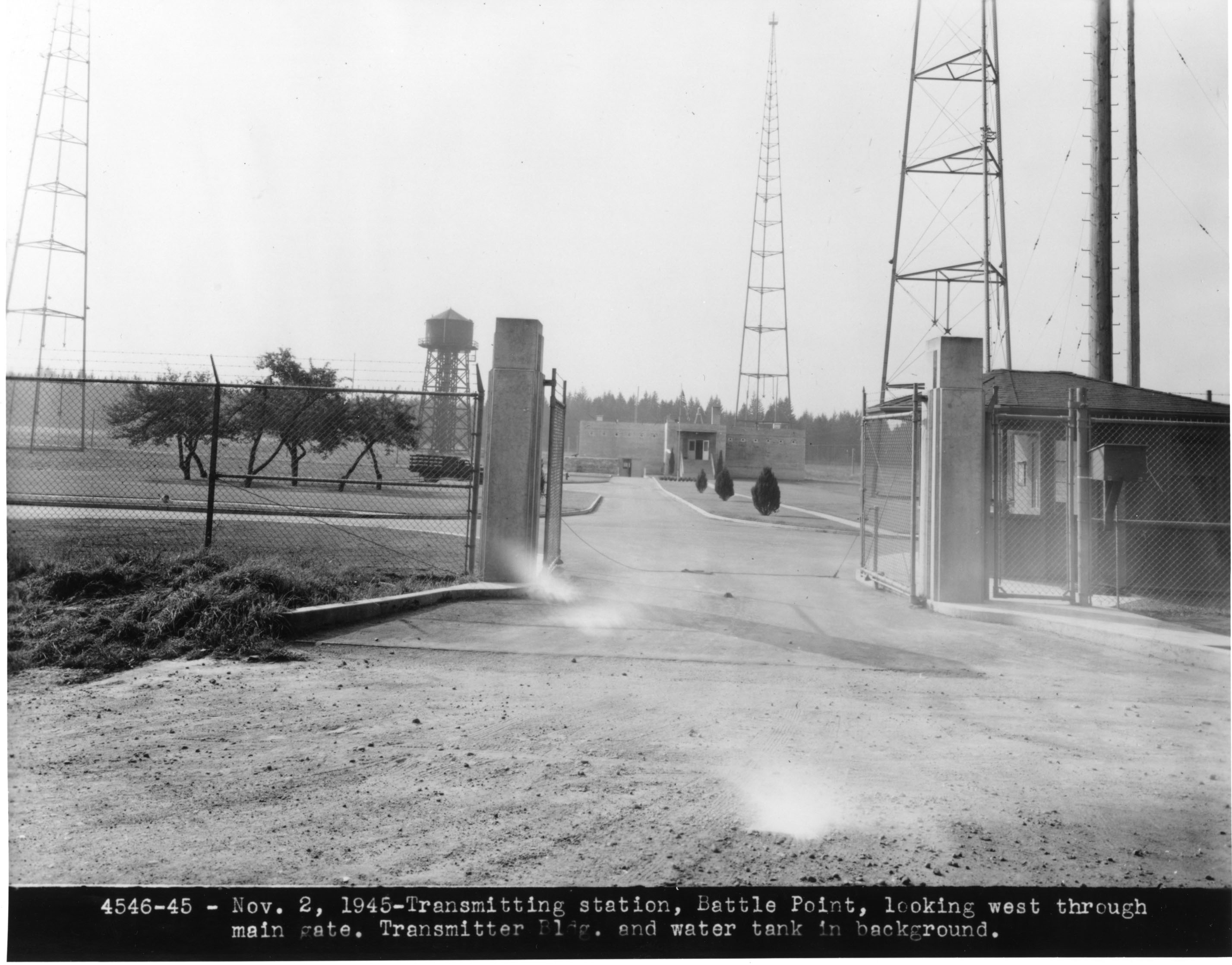
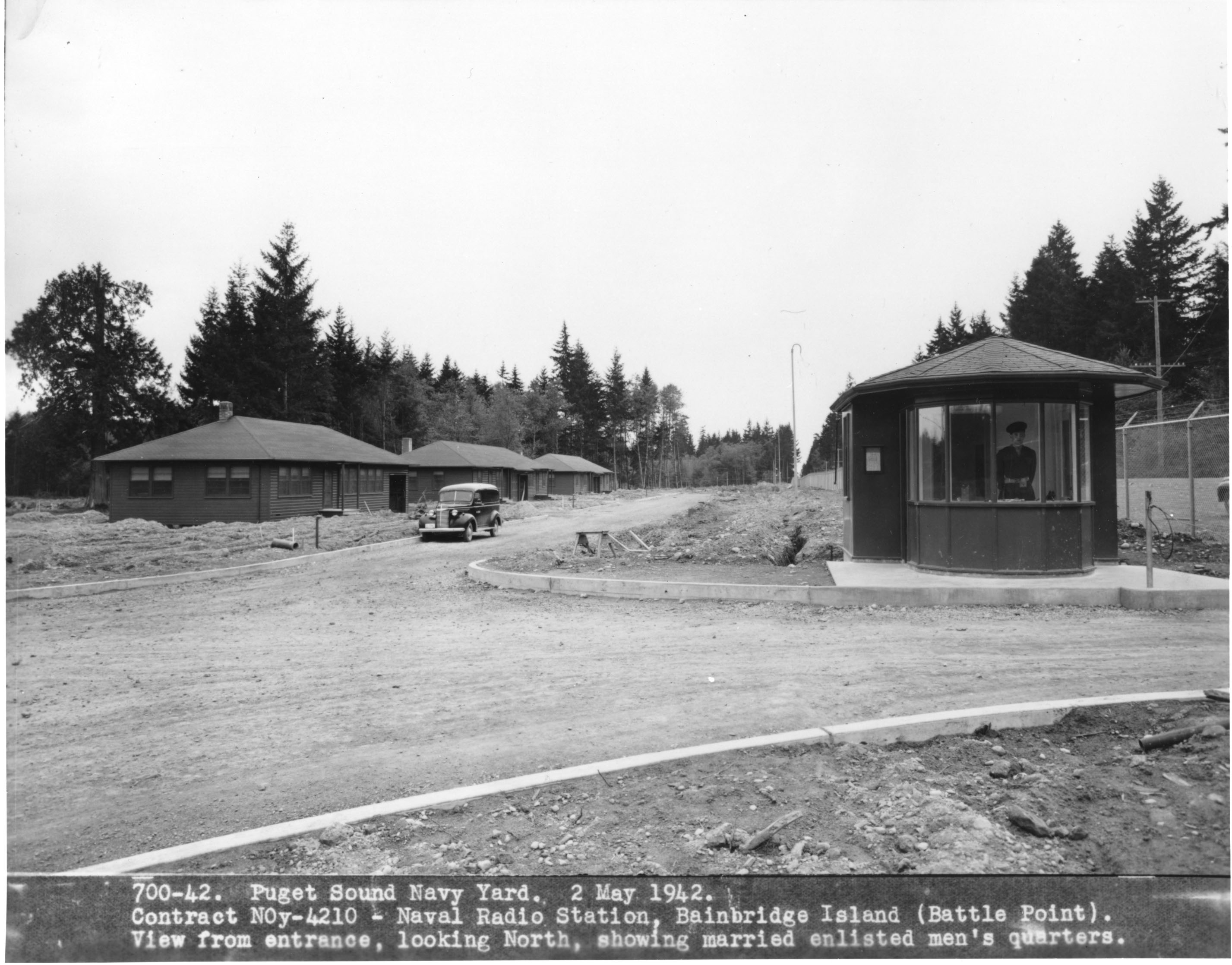
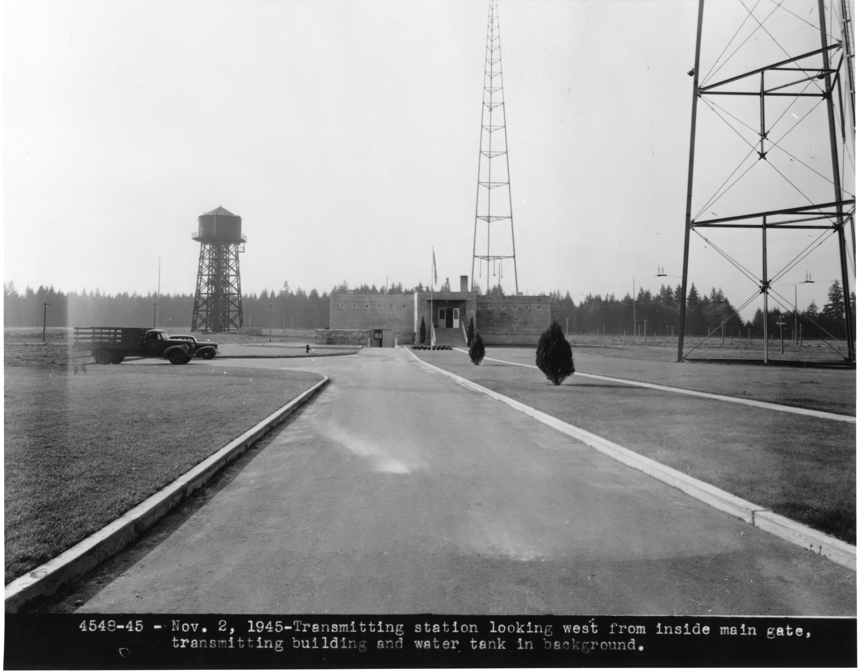
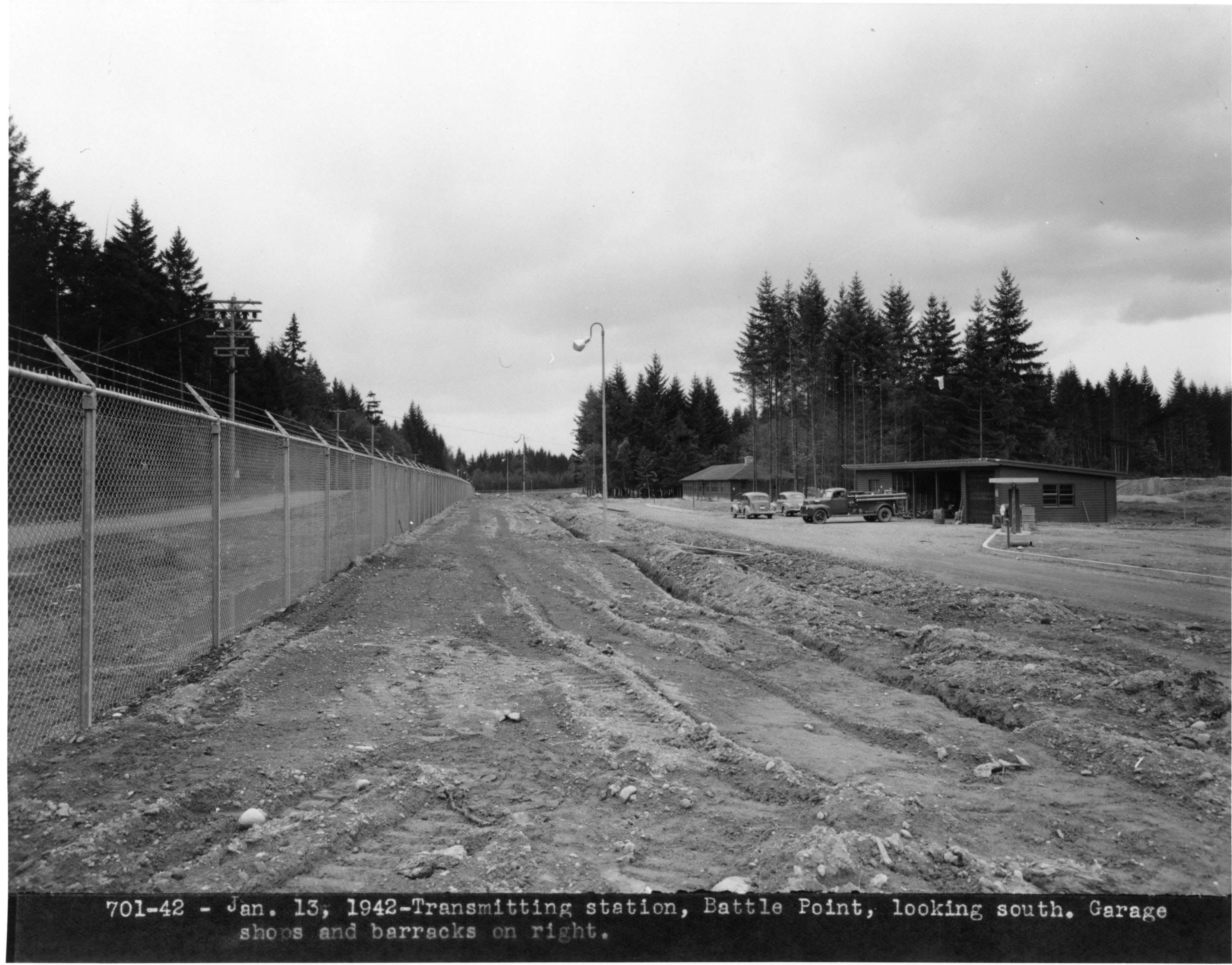
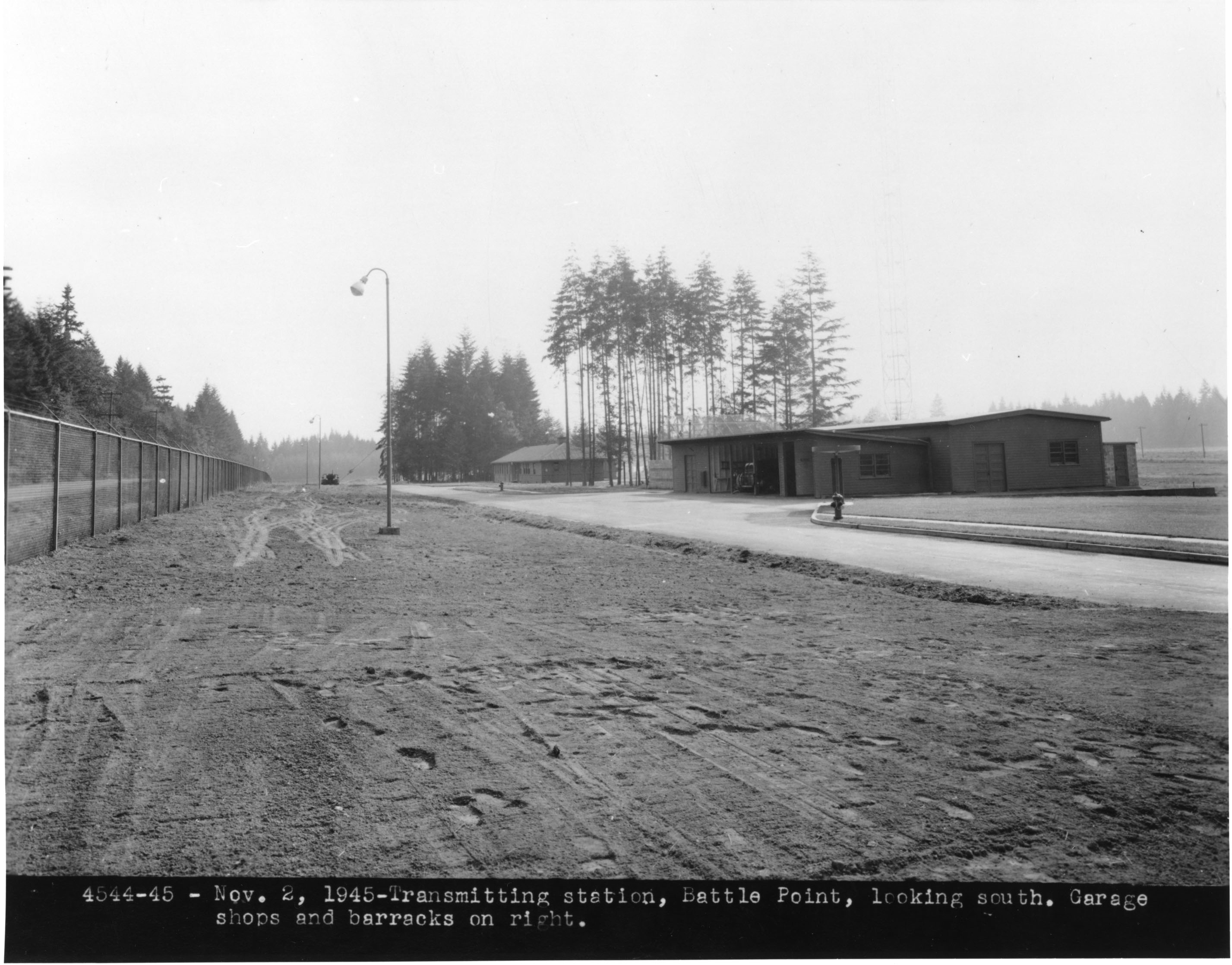
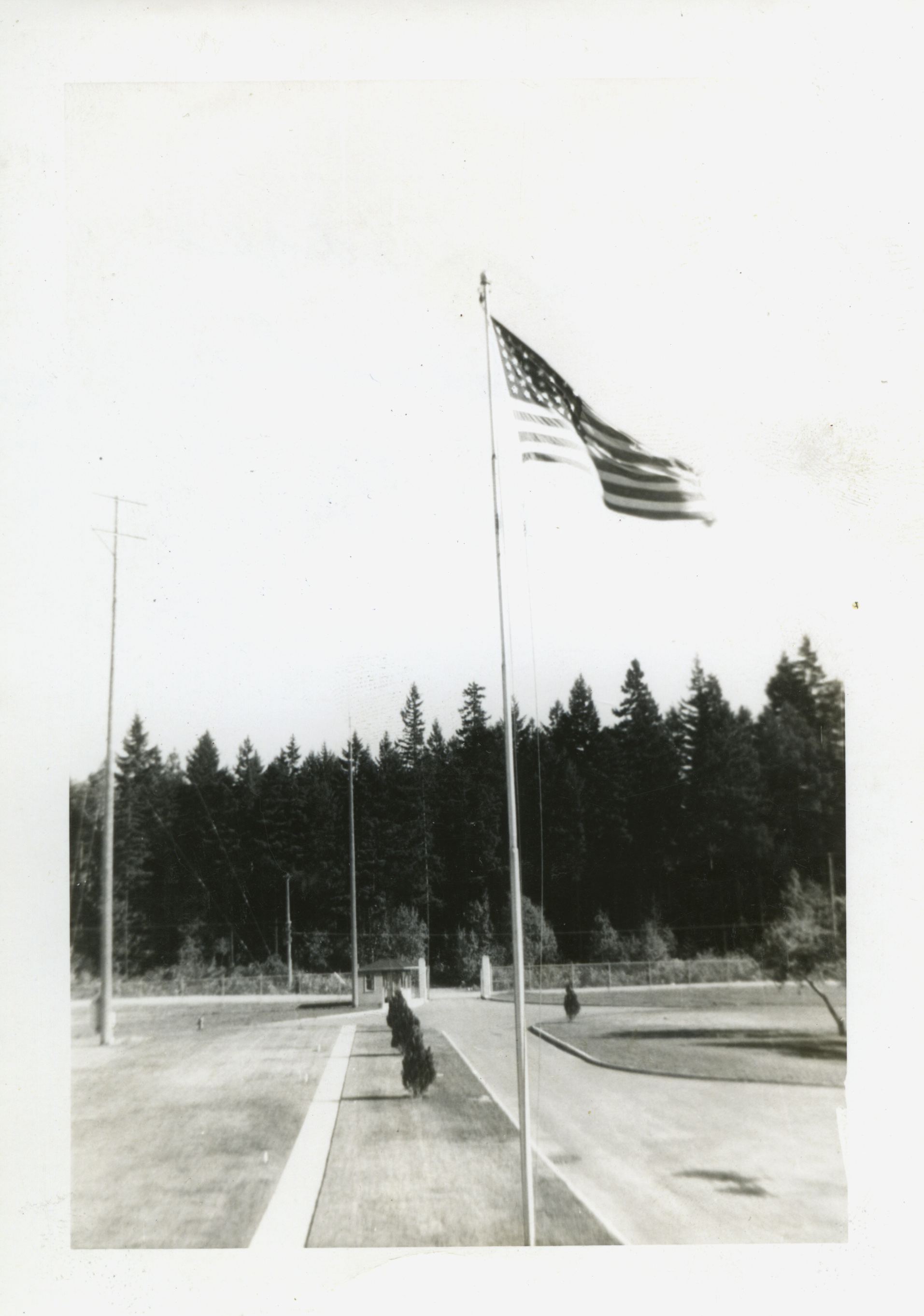
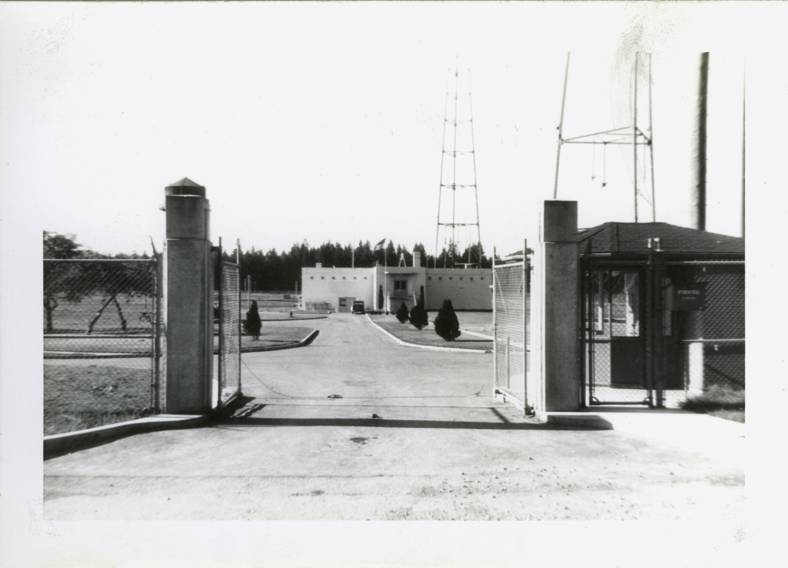
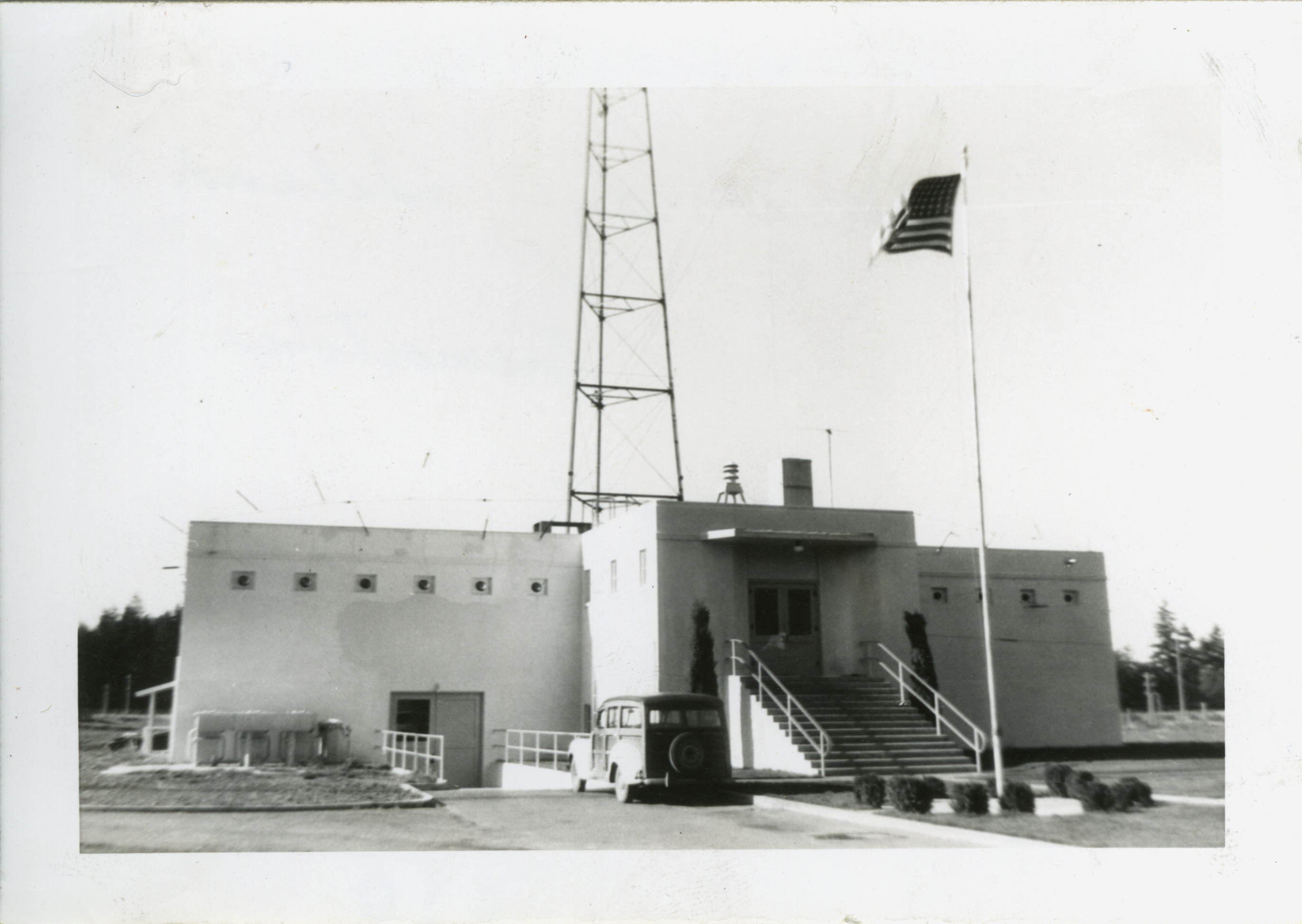
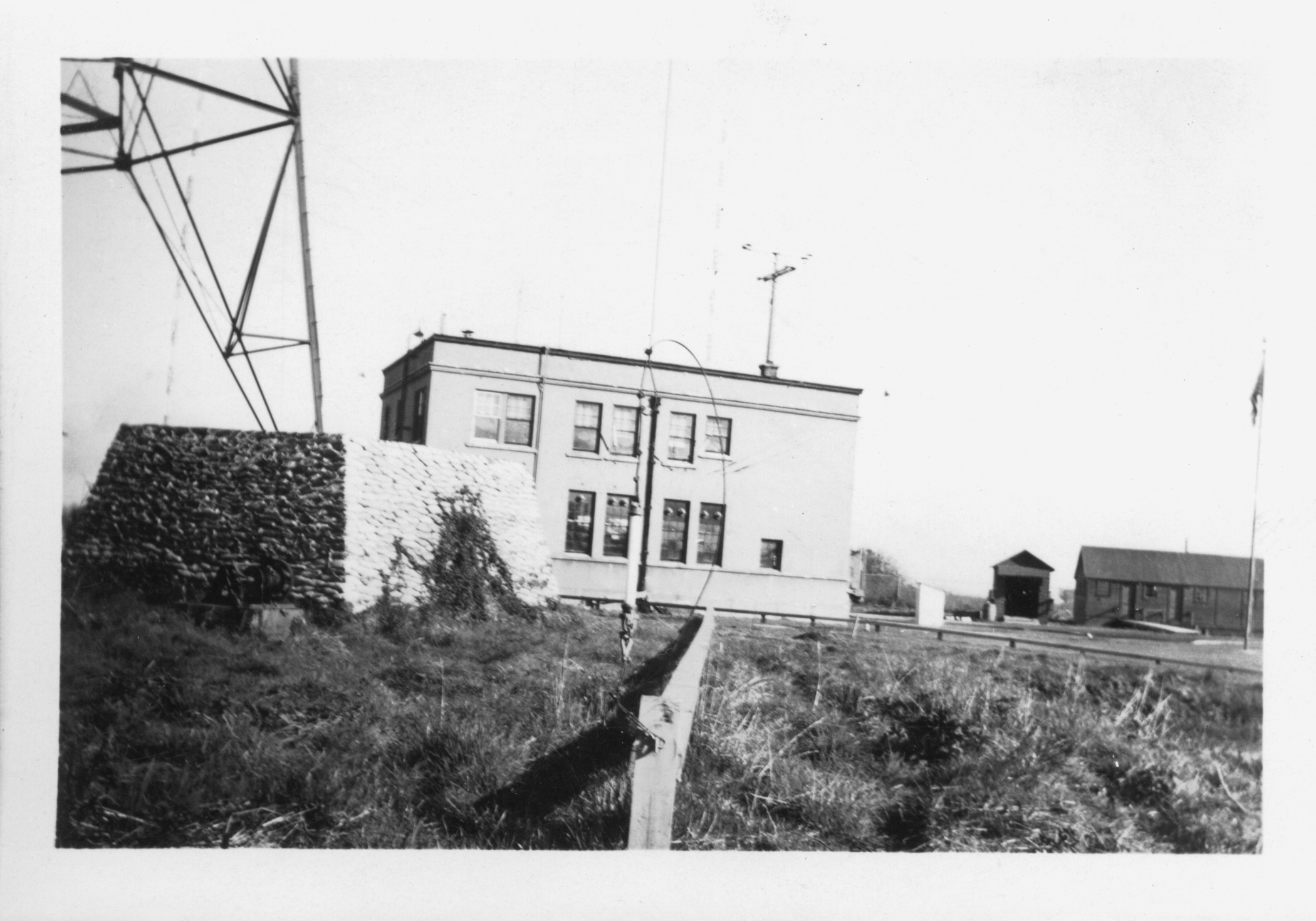
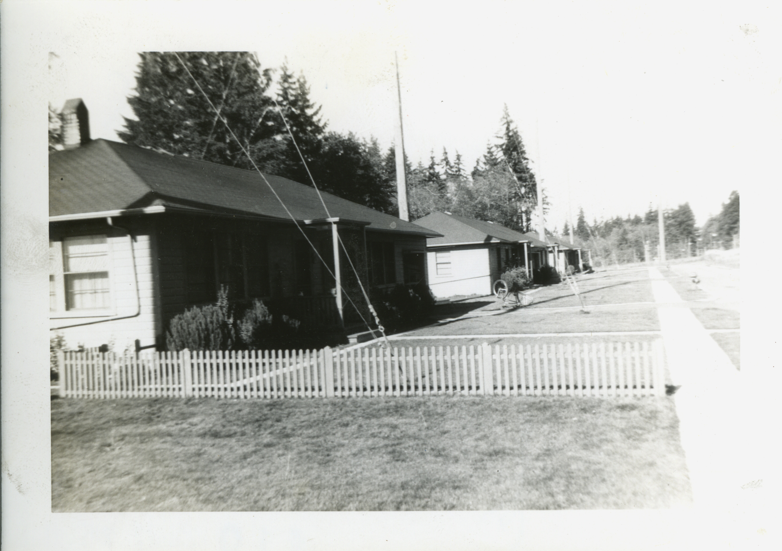
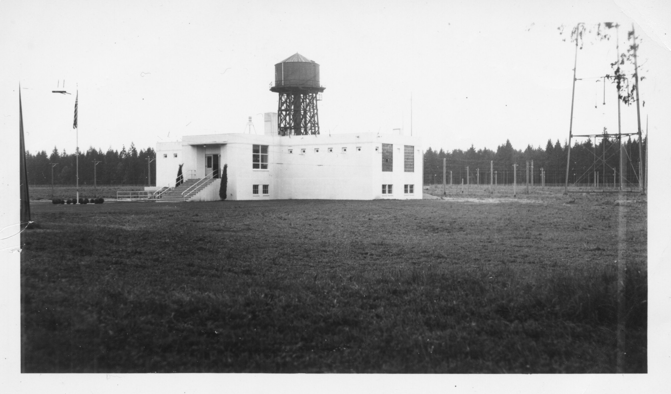
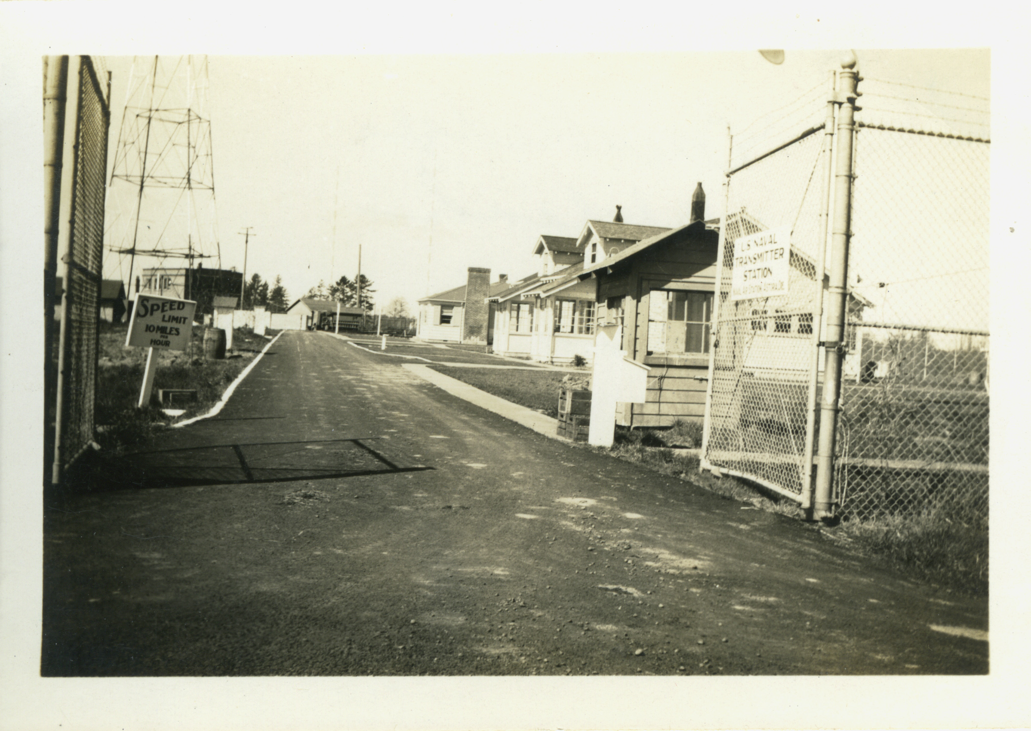
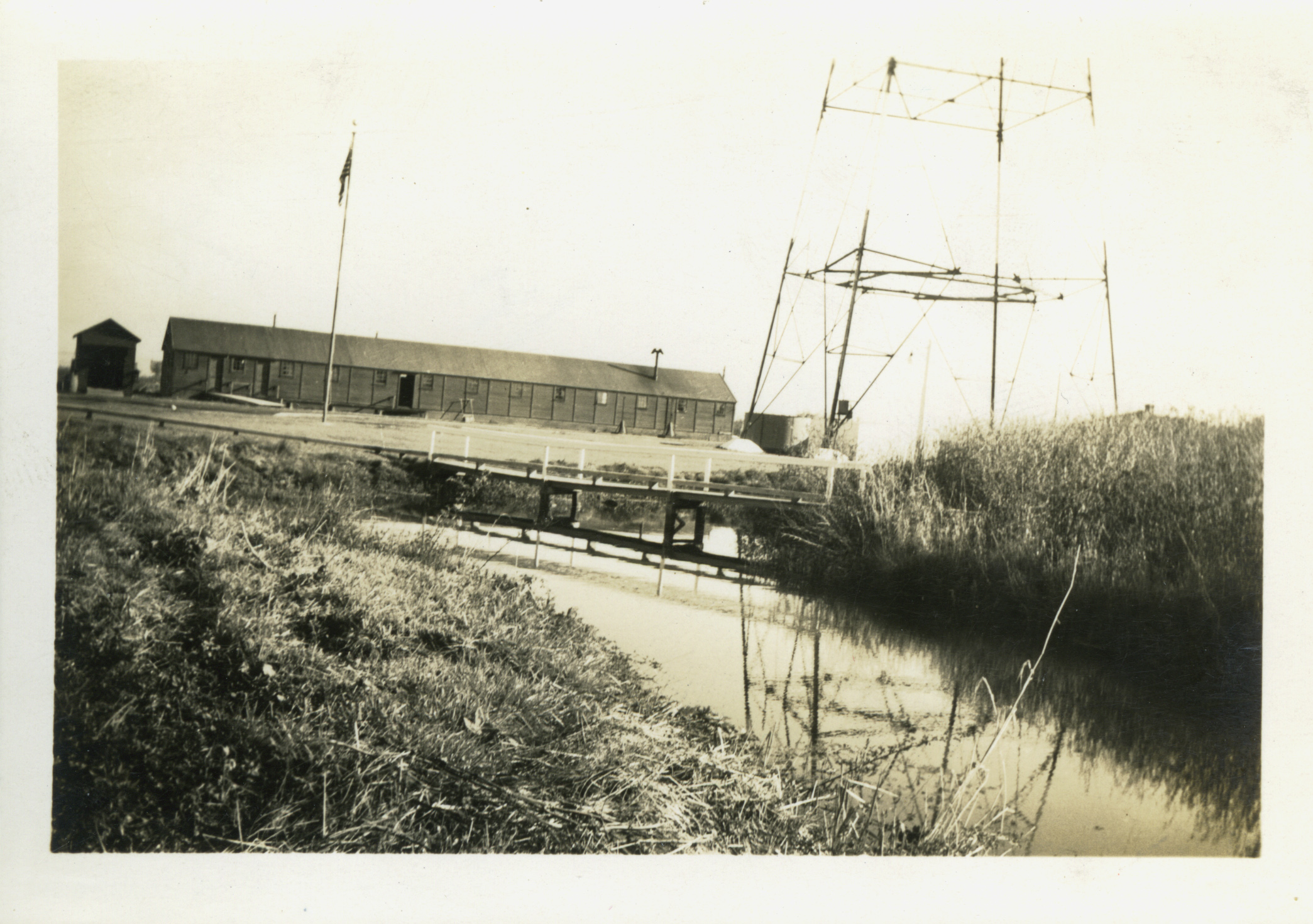
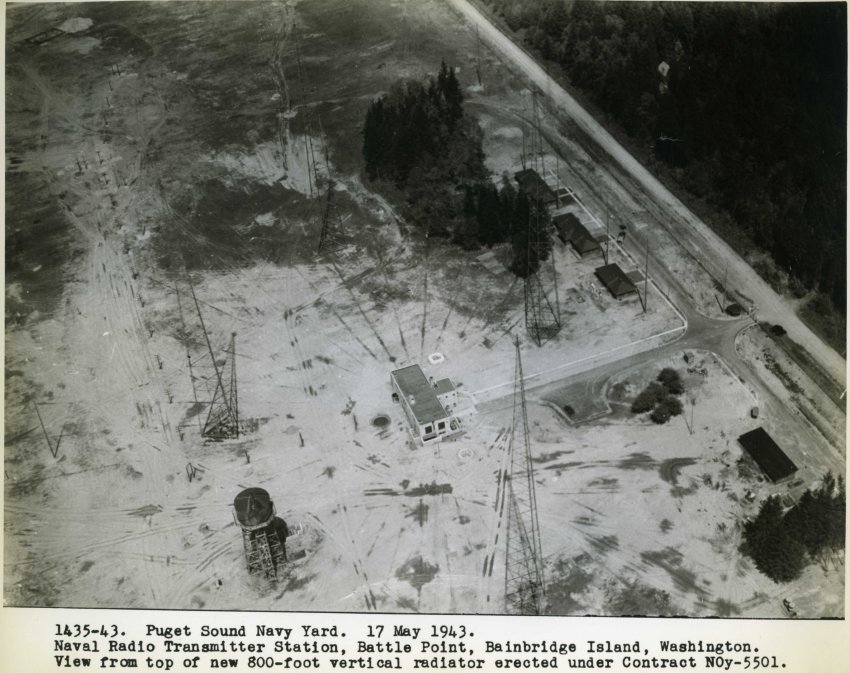
The expansion of the Park District in 1972 would be at the site where the Navy built a radio station at the beginning of World War II. The Navy acquired the property consisting of several farms and timber properties in April of 1941. They cleared 90.39 acres and built ten structures including four 300 ft. radio towers, one 800 ft. radio tower, a maintenance shed, barracks, transmitter building, helix house (a stout concrete building), mess hall, etc. A 900 foot deep well was drilled to supply water for the station. An elevated 75,000 gallon water tank was built as well. The entire area was fenced.
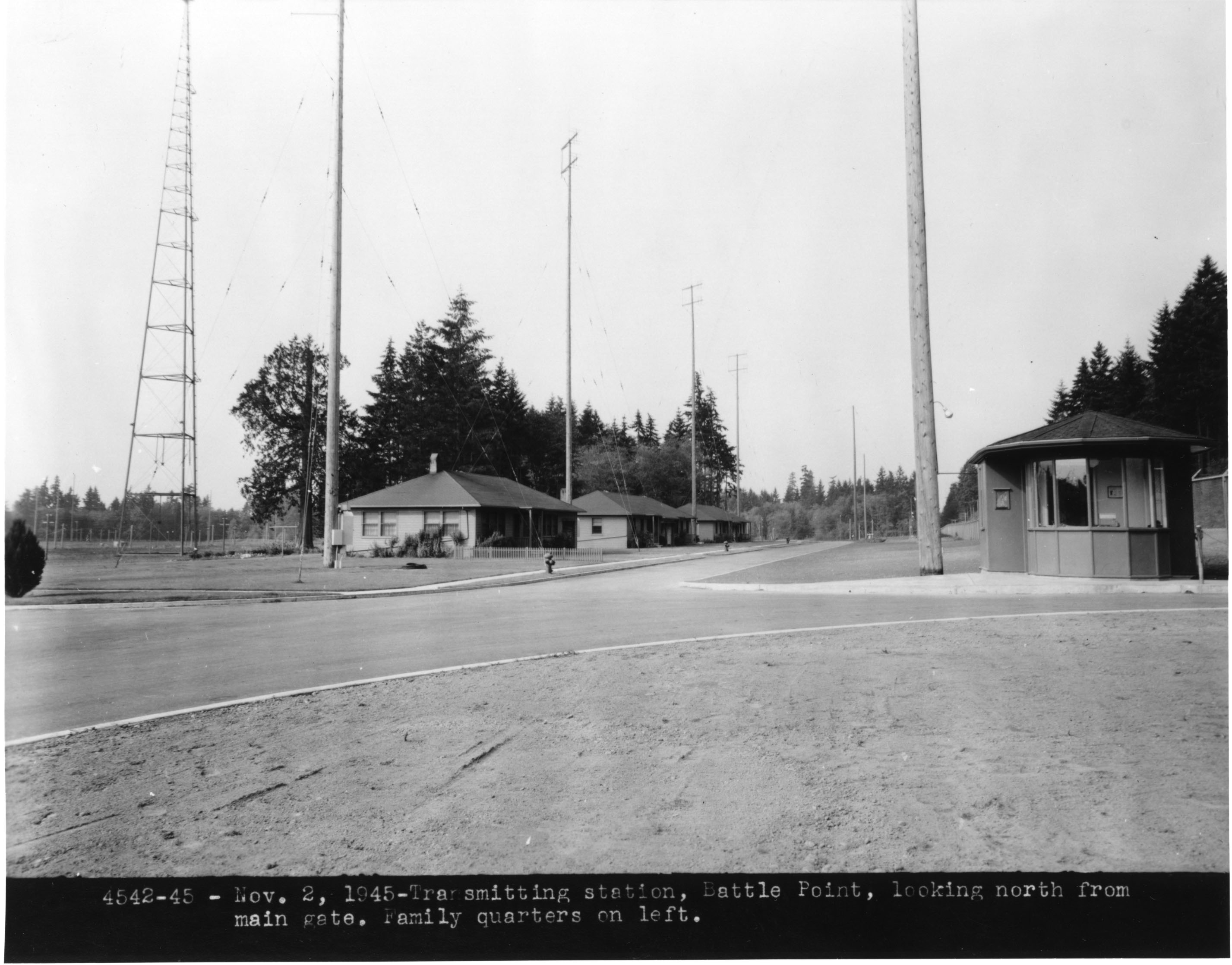
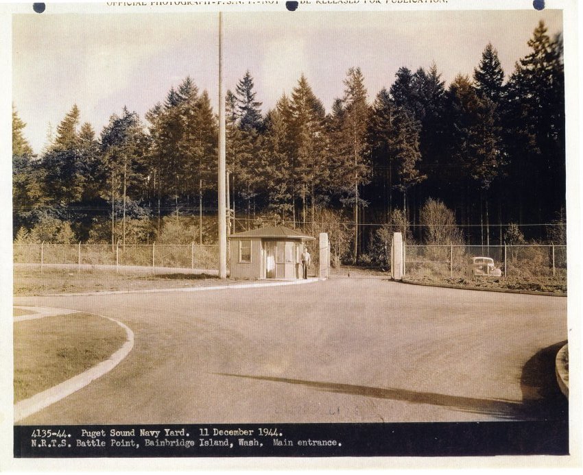
On Arrow Point Drive across from the entrance to the station was a small roadside shelter. Its counterpart could be seen at Navy and Army posts all over the country because military personnel were forbidden to hitch-hike while in uniform. These shelters protected one from the elements while waiting for a bus, or hoping that some kind motorist would respond to the message on a nearby sign which read something like “A serviceman would greatly appreciate a ride.”
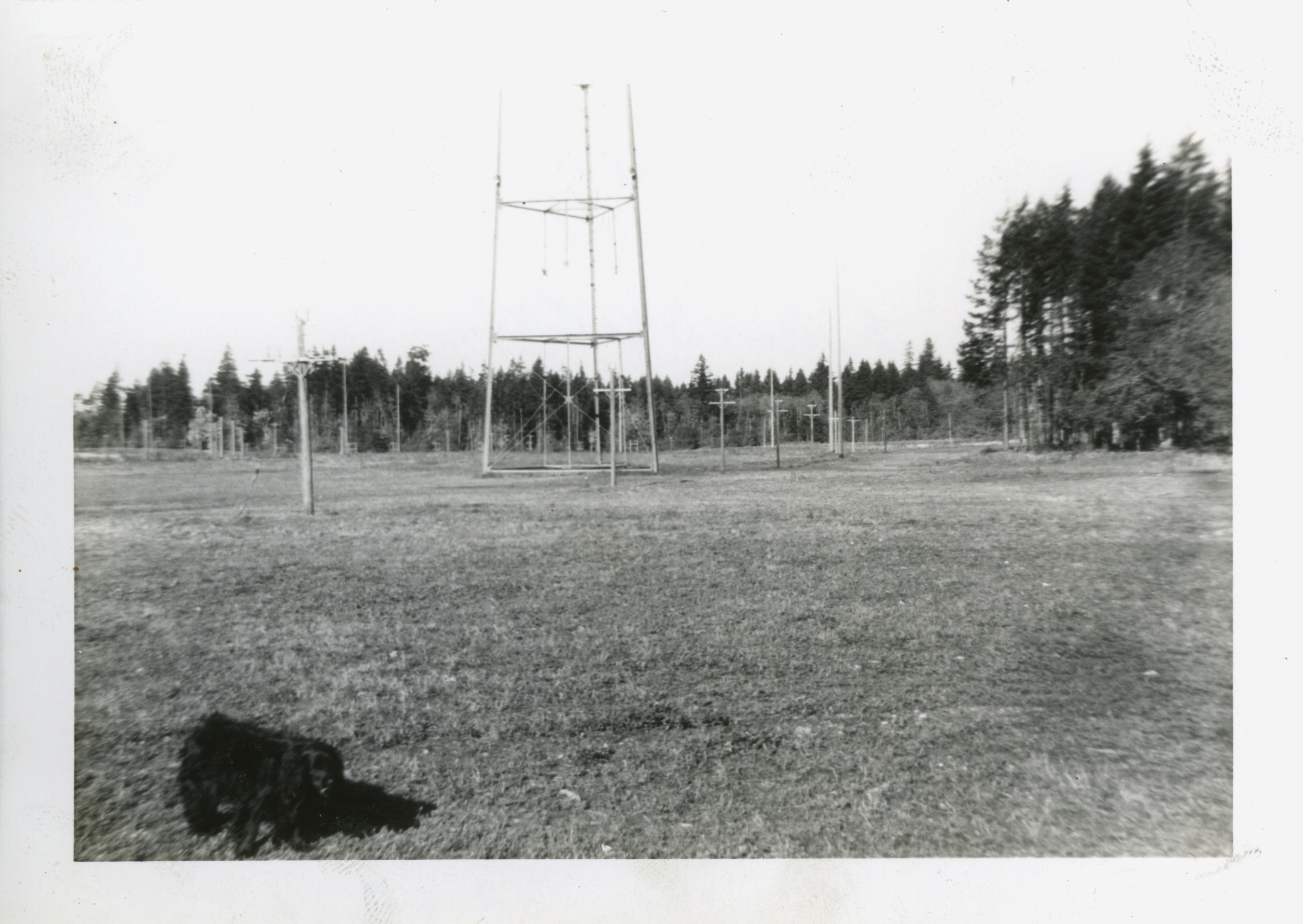
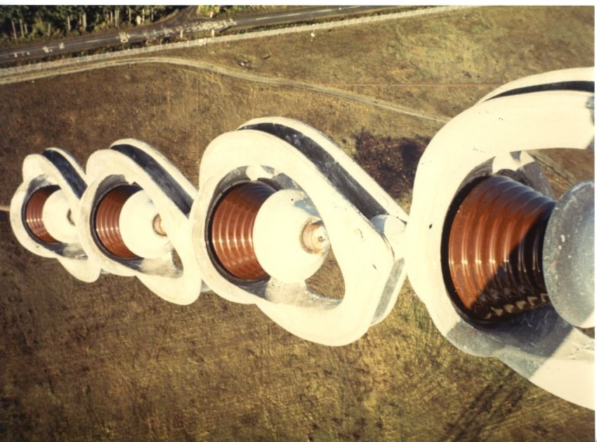
In addition to the towers at the station, there was a ground screen and radial system, which covered 26 acres. Immediately below the 800 ft. antenna, and very close to the surface, was an area 75 feet in diameter covered by copper screen. Soldered to the outer edge of the screen were 240 pieces of No. 8 copper wire, arranged radially, each 525 feet long, resembling a compass rose. At the end of each wire were 8 ft. ground rods. The full screen and wire diameter was 1200 feet and used over 3 tons of copper and about 24 miles of wire. The tall tower was supported by eight guy wires which reached nearly to the edge of the fence on the east, west and south. There were large insulators near the tower in each guy wire. The anchors for the tower were very large concrete blocks sunk into the ground. (When the park was being developed it was found to be impossible to dig these anchors up so they were simply buried.)
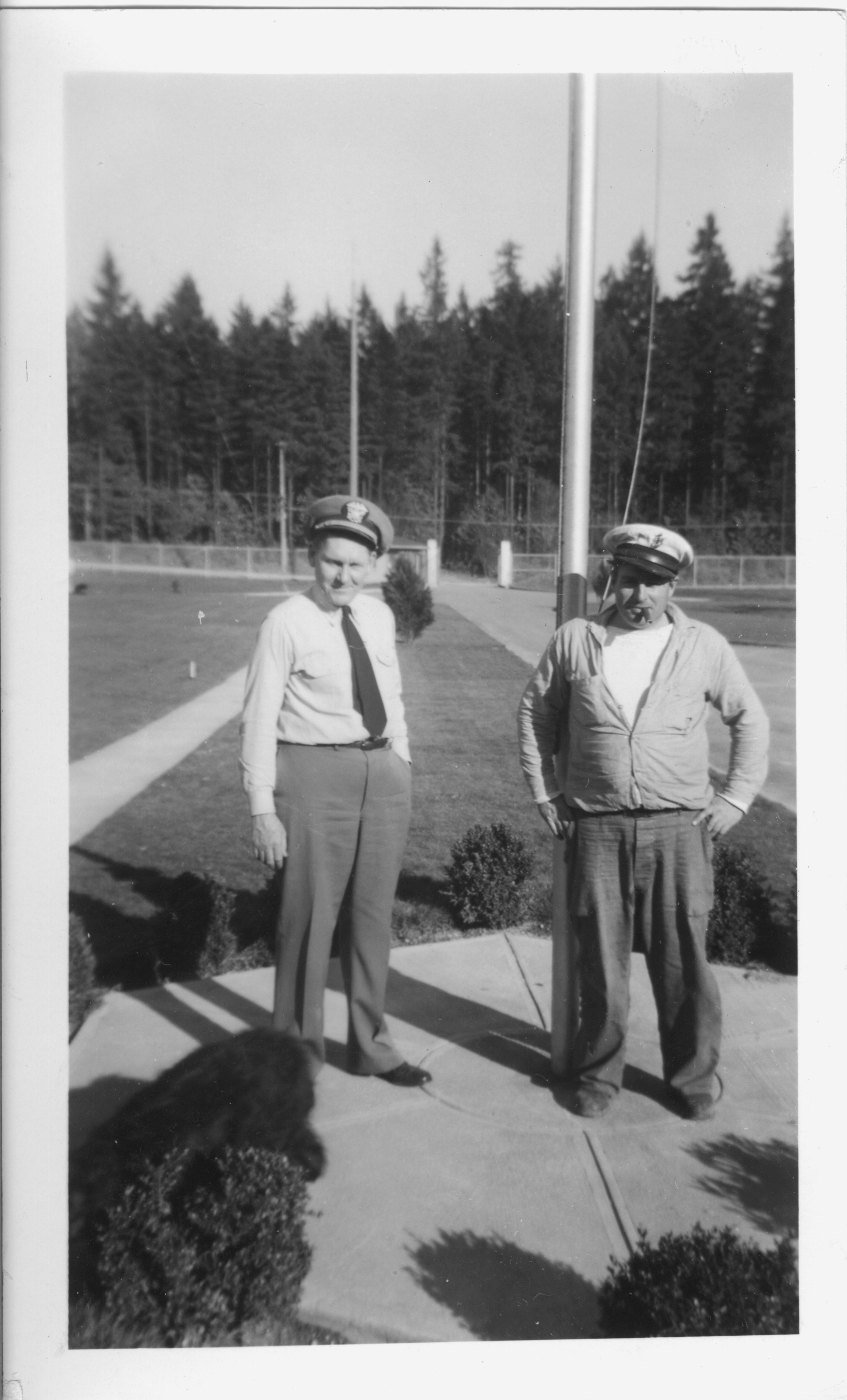
The radio station played an important role during World War II and the Korean War. It was a vital communication link between the US mainland and the North Pacific fleet. As many as forty men were based at the station at one time. With the 800 foot tower, the station was able to send and receive radio signals from the Pacific Fleet and even communicated with the submarine fleet when a new low frequency transmitter was installed. Signals were also sent from the station to Fort Ward and to Seattle.
The station was deactivated on March 31, 1959 and all equipment was removed by 1971. After deactivation, the property sat idle and it is noted that prior to its being declared surplus property, the GSA caretaker issued a grazing permit to Mr. Englebert which was rescinded with the transfer to the Park District.
The land at Battle Point was declared surplus property by the Navy in 1971 and turned over to the General Services Administration to be disposed of. The National Oceanic and Atmospheric Administration took a look at the property and the Bainbridge Island School District applied for the land but was turned down as they could not demonstrate an immediate need. The Park District then applied and was granted the land on May 5, 1972. There was a proviso in the transfer that the District would remove the five radio towers on the site. They also had to agree to establish a schedule for development which would turn the site into a facility for public recreational use.
After learning of the award to the Park District, the Suquamish Tribe made a claim to all or part of the land. Under the terms of the transfer to the Park District, there was no opportunity to give up any of the property. In addition, the Park Board felt the entire area was needed for future development needs so the claim by the tribe was rejected.
Within days of the transfer of the site to the Park District, Director Dennis McCurdy, Larry Burris and Commissioner Fred Grimm climbed the 800 ft. tower. They spent one and a half hours climbing the tower and less than one half hour descending. The three of them ate lunch at the top of the tower. Larry remembers this climb as one of the significant things he has done. He recalls seeing water on every side of the island and seeing a ferry between Seattle and Bainbridge.
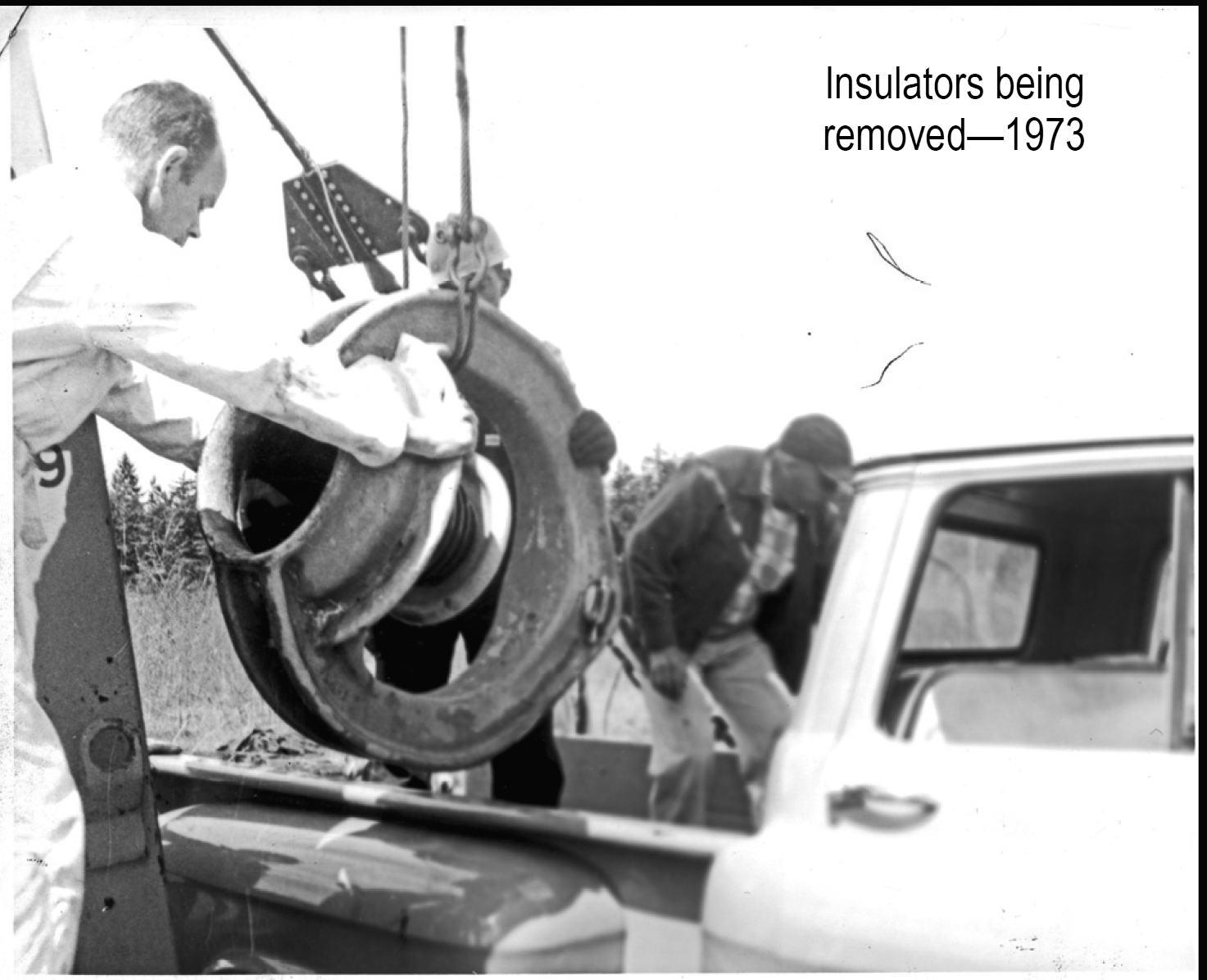
Bids were solicited for the removal of the towers and a salvage firm in Seattle submitted a bid of $1 in exchange for having the salvage rights to the for payment to remove the towers. There was a total of 311 tons of steel and 4,690 lbs. of copper recovered from the towers.
In early January of 1973, Director Dennis McCurdy resigned over a dispute concerning Park District policy. Larry Burris was hired as director on May 2, 1973 after having acted as temporary director following McCurdy’s resignation.
John Rudolph from Bainbridge and Jones and Jones from Seattle were hired to develop a master plan for the development of the park. The plan included ball fields, tennis courts, irrigation, soccer fields and an equestrian area as well as picnic areas, jogging/ walking trails and passive areas. The District asked voters in the November 1973 election for funds to implement the park master plan; the measure failed. A special election was then held in January of 1974 and the issue passed with 76% support. The levy authorized $42,782 from Island voters to develop the park. With that money, the District applied for matching funds from the Interagency for Outdoor Recreation (now the Recreation and Conservation Office). Funds for the project were approved on December 12, 1974 in the amount of $171,128. The State provided $42,782 in matching funds and the balance came from the Land and Water Conservation Fund administrated by the Interagency for Outdoor Recreation.
In internal Park
District discussions, someone
reported that a park had been
developed “somewhere” with
the help of the National Guard.
A decision was made
to contact Senator Henry M.
Jackson in an effort to gain
similar support.
This resulted in a The Park District staff completed Later, the helix house was converted The Park District became the The District now owns or manages Information for this article came from: